40 Years Behind a Viewfinder
Since early childhood, whenever traveling, I’ve had a camera in hand — from my first Kodak Instamatics with four-bulb flashcubes to entry-level Nikon SLRs, the first pivoting-head Nikon Coolpix digitals, superzoom Canon PowerShot digitals and a medium-format Mamiya 645. Today I use a Canon DSLR equipped with a range of lenses and have a full studio setup of strobes, softboxes and umbrellas.
My travel photos — mostly spanning the Lower 48 states and national parks — have been published in travel guides, in magazines and online.
If you see an image below you’d like to publish, a related story you’d like me to write, or are curious to know whether I’ve photographed a subject you are covering, reach out to me.
Route 66 — Chicago to L.A.
The gallery below focuses on Route 66, which marks its centennial in 2026. I’ve selected an even 100 images in honor of the anniversary, but I’ve taken thousands more photos of these sites and countless others across the eight states — Illinois, Missouri, Kansas, Oklahoma, Texas, New Mexico, Arizona and California — traversed by the “Mother Road.”
All images below © 2026 David Lauterborn. All rights reserved.
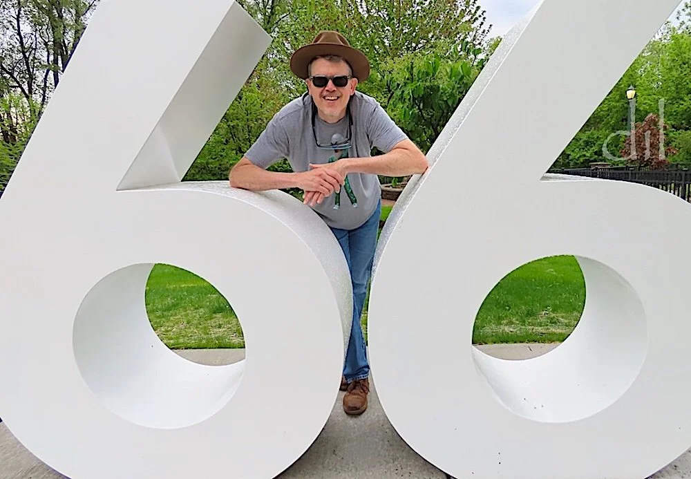
By the numbers at Route 66 Park in Joliet, Ill., a roadside pullout with a vintage gas pump, cars and the Rich & Creamy ice cream stand, capped by figures of the Blues Brothers of camp film fame.
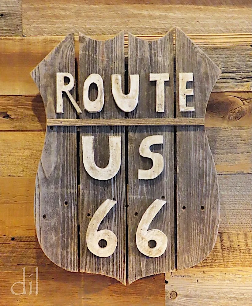
Route 66 signage and memorabilia line the walls of the Old Route 66 Family Restaurant in Dwight, Ill.
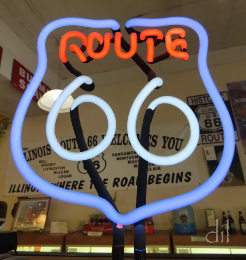
Start your "Mother Road" education at the artifact- and memorabilia-filled Route 66 Hall of Fame & Museum in Pontiac, Ill.
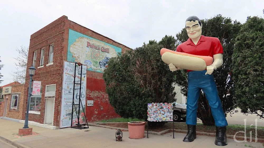
A survivor from the heyday of roadside advertising, this onetime Paul Bunyan in Atlanta, Ill, now cradles a hot dog instead of an ax. Atlanta is also home to the American Giants Museum, which restores such "muffler men" of yesteryear.
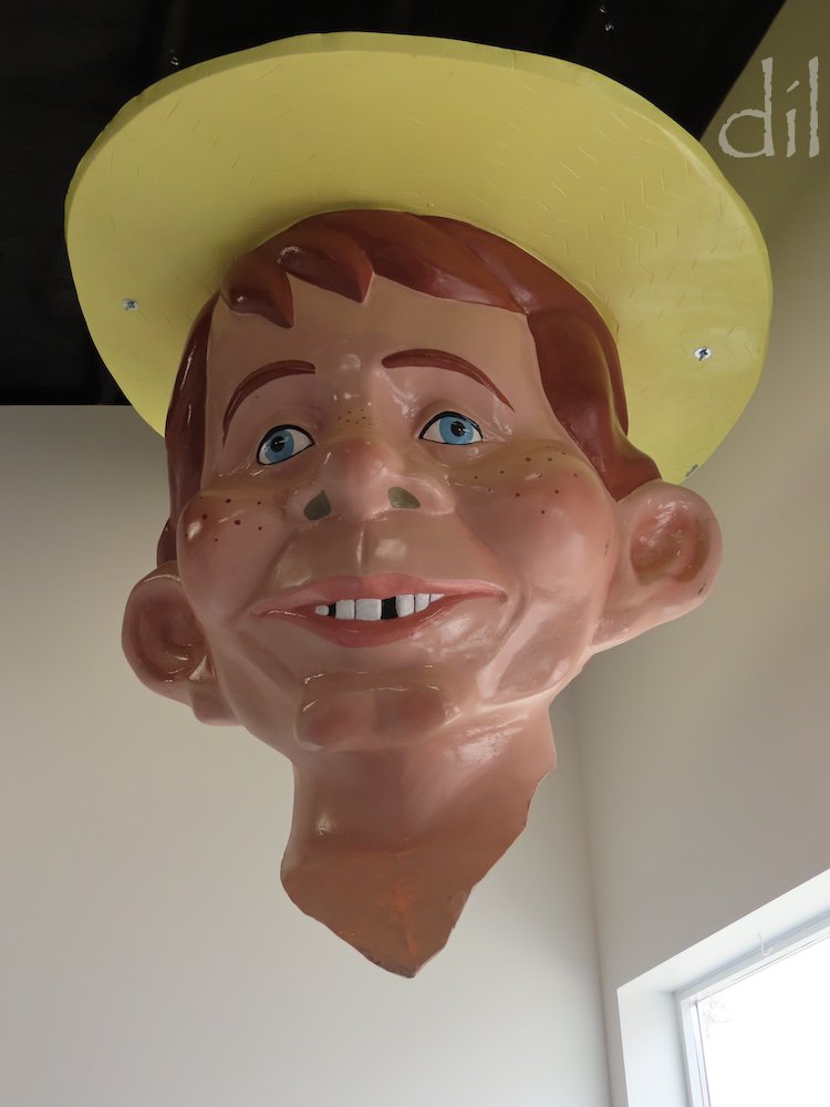
This disembodied giant is a depiction of Edgar Bergen's ventriloquist dummy Mortimer Snerd, not Alfred E. Newman.
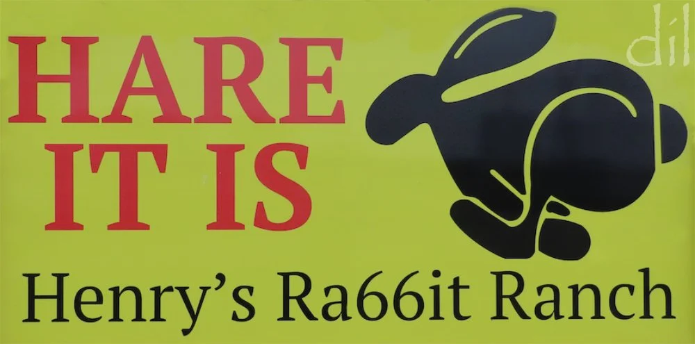
The highlight at Henry's, in Staunton, Ill., is a row of half-buried Volkswagen Rabbits, a tongue-in-cheek ode to Amarillo's famed Cadillac Ranch. The sign pictured above is a hat tip to yet another Route 66 landmark. Find photos of both referenced roadside attractions below.
The centerpiece of St. Louis, Gateway Arch is one of a score of national parks on or near Route 66. Two 40-passenger trams with pods suspended like Ferris wheel cars climb each leg to the observation deck of the 630-foot-tall stainless-steel span. Views take in the city, the Missouri River and neighboring Illinois.
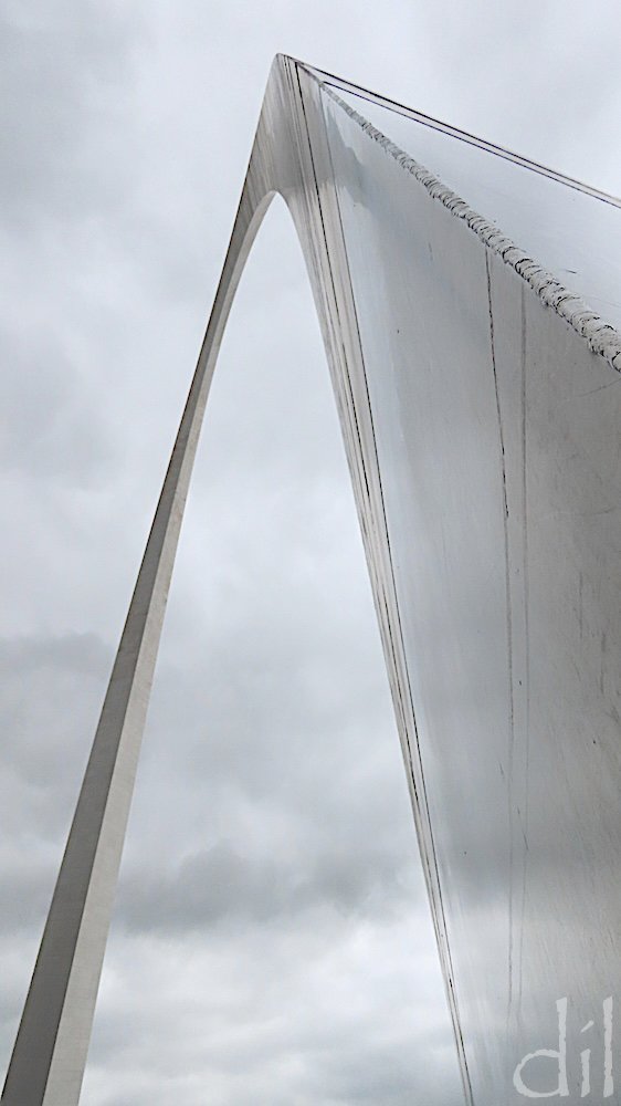
The silvery skin of the arch merged into the sky on this overcast afternoon. The perspective from the top was also a surprise.

Gazing straight down at the national park grounds and legs of the arch (at lower right and left) is like looking at a miniature diorama.
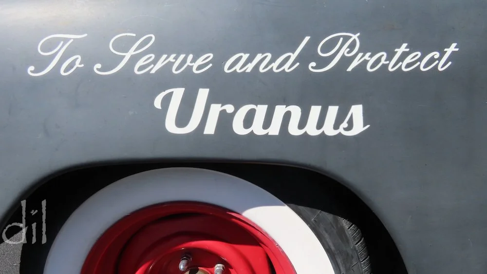
The puns are predictable at Uranus, a tourist haven or trap (depending on one's sense of humor) in south-central Missouri. Don't miss the on-site fudge factory or gimmicky gift shop.
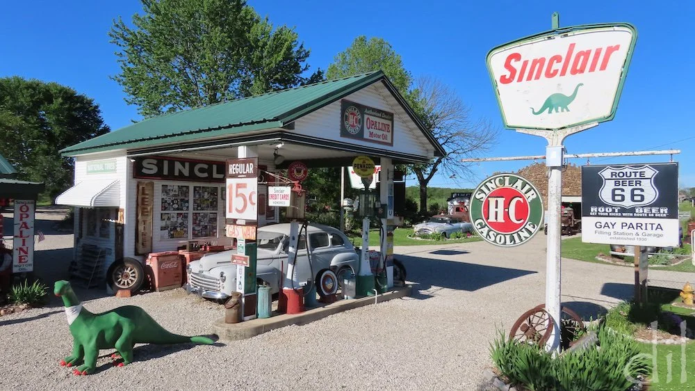
Gary's Gay Parita, in Paris Springs, Mo., is a perfect time capsule of a Sinclair gas station. The company's brontosaurus mascot is present on the vintage sign and in a promotional fiberglass figure by the pumps.
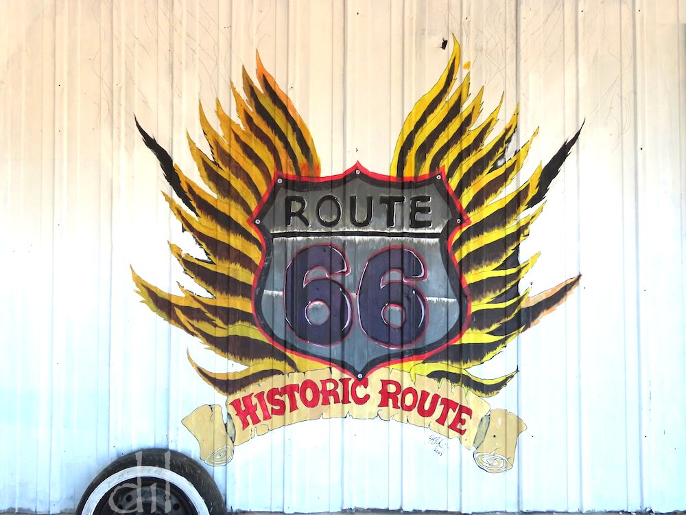
Life in Baxter Springs, Kan., centers on the Mother Road. The town in part inspired the bypassed wayside of Radiator Springs in the Pixar film Cars. Scour the streets for vehicles painted like that film's stars.
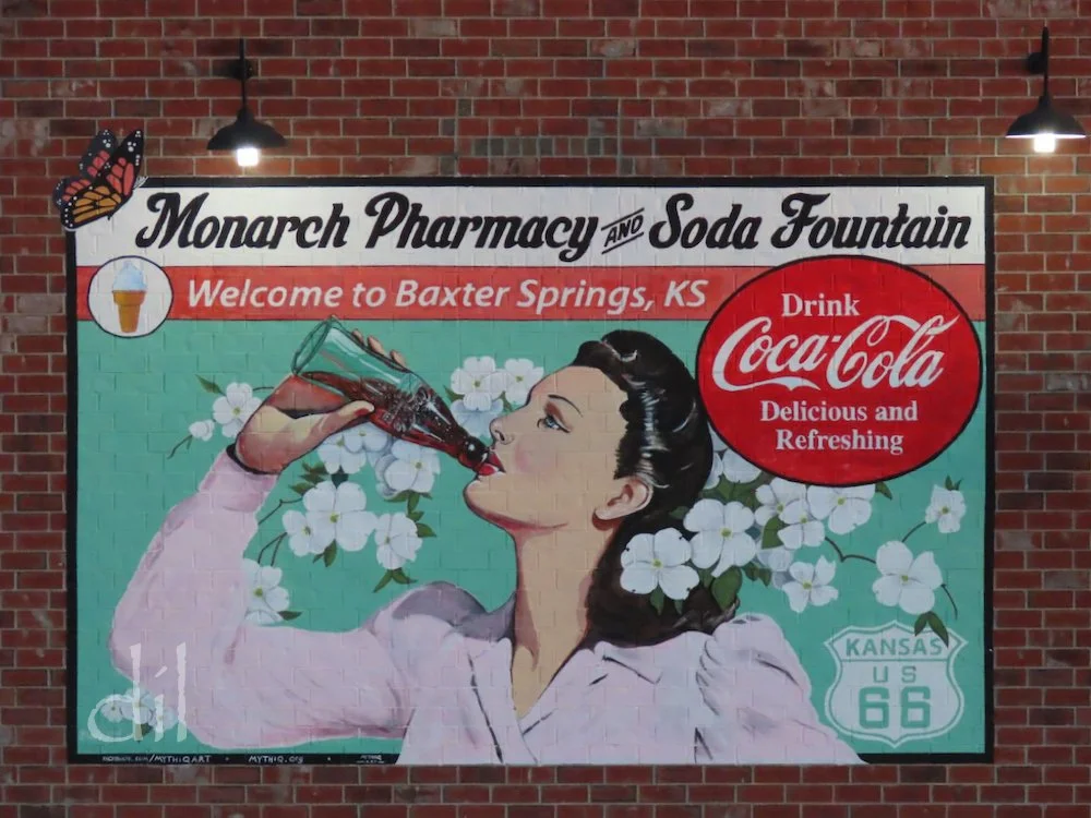
Baxter Springs' Monarch Pharmacy still operates its old-time soda fountain, serving scoops of Anderson's Ice Cream from across the border in Joplin, Mo.
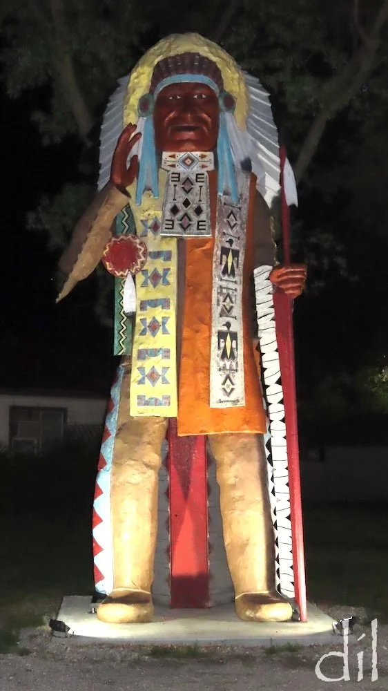
The staff of the American Giants Museum restored the Big Indian and moved it to the grounds of the Hi-Way Café in Vinita, Okla., in 2023.
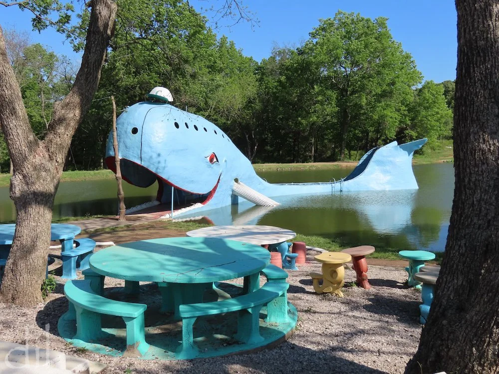
A Route 66 favorite since 1972, the Blue Whale of Catoosa, Okla., was a surprise gift from a local zoologist to his wife, who collected whale figurines and liked to swim in their spring-fed pond. As tourists increasingly stopped for photos, the family added picnic tables and opened the site to the public.
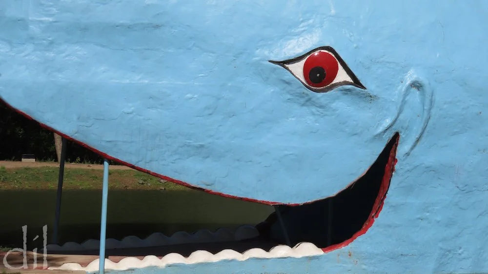
Visitors can enter, Jonah-like, through the Blue Whale's grinning mouth. Though the 80-foot-long structure is fitted with a sundeck, waterslides and ladders, swimming is no longer permitted. You'll still have a whale of a time.
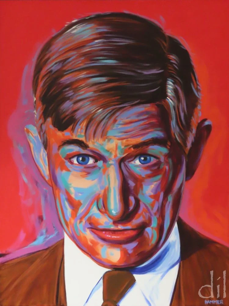
The Will Rogers Memorial Museum, in Claremore, Okla., relates the life of the popular humorist (1879–1935), depicted here in a work by John Hammer. The museum and adjacent family tomb sit on ranchland Rogers had bought for retirement before his tragic death in a plane crash.
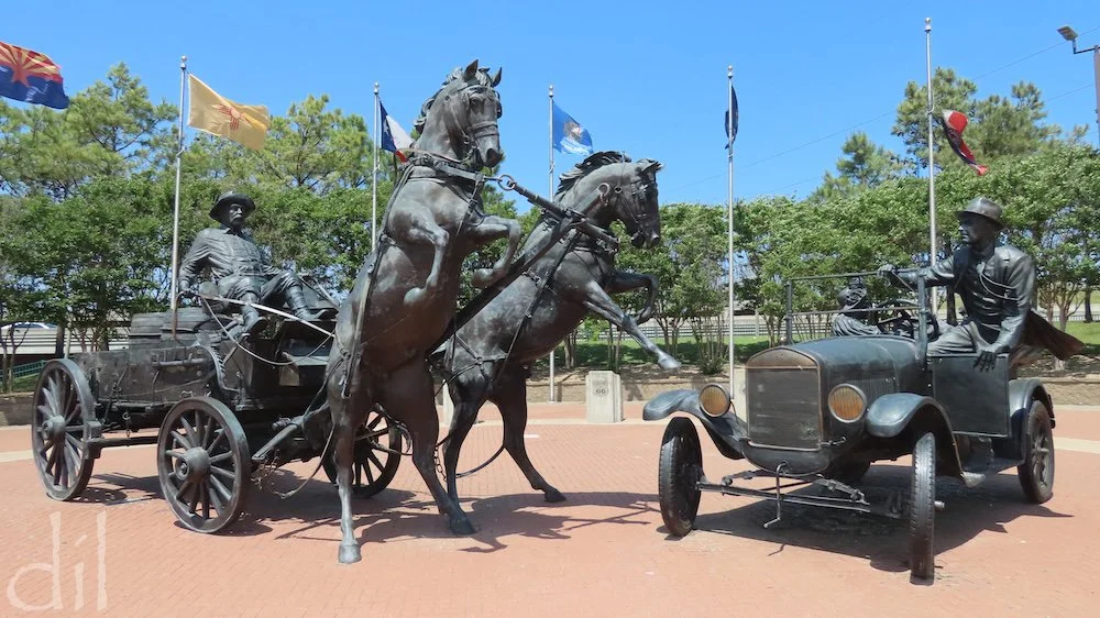
Businessman Cyrus Avery (1871–1963) first proposed the Chicago–L.A. corridor for Route 66. Texas artist Robert Summers' bronze "East Meets West," at Cyrus Avery Centennial Plaza in Tulsa, Okla., depicts the Avery family of the modern era in a Model T spooking a wagon team of horses from the soon-to-be past.
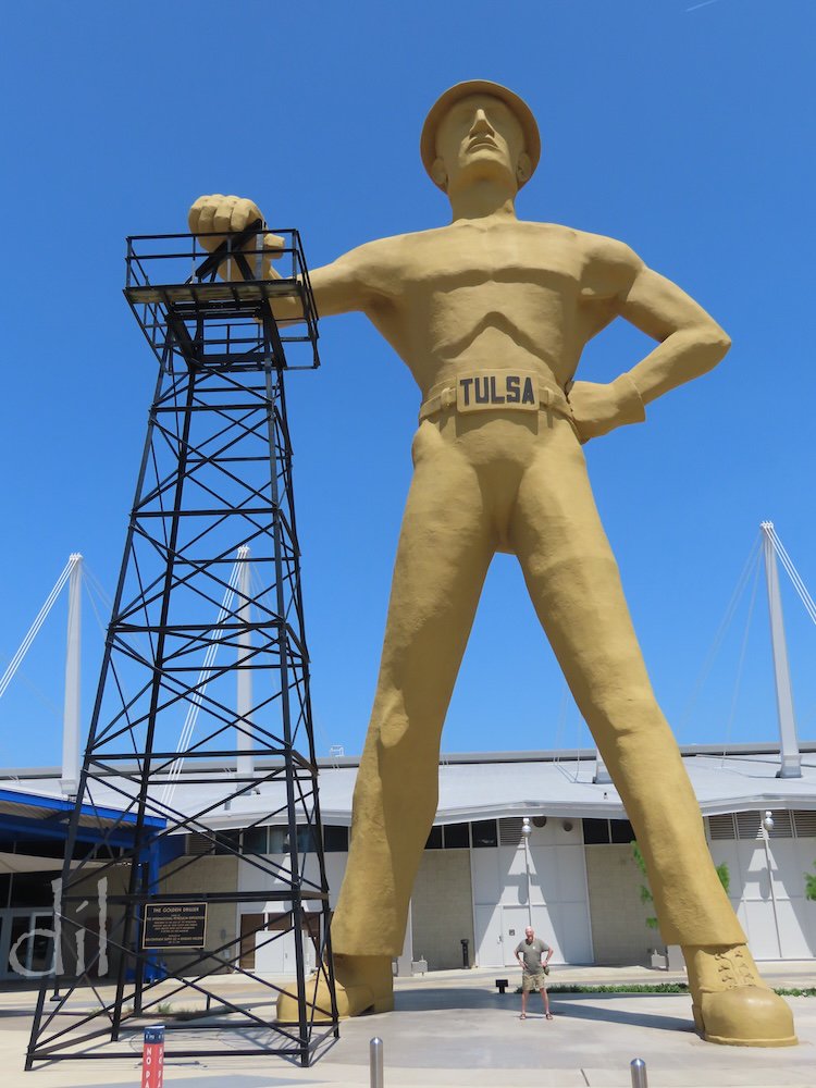
Soaring 75 feet (that's my father posing between its feet), Tulsa's Golden Driller is the nation's seventh tallest statue. Its hand rests atop an actual repurposed oil derrick. The statue stands beside the Tulsa Expo Center, which hosts the state fair and other big annual events.
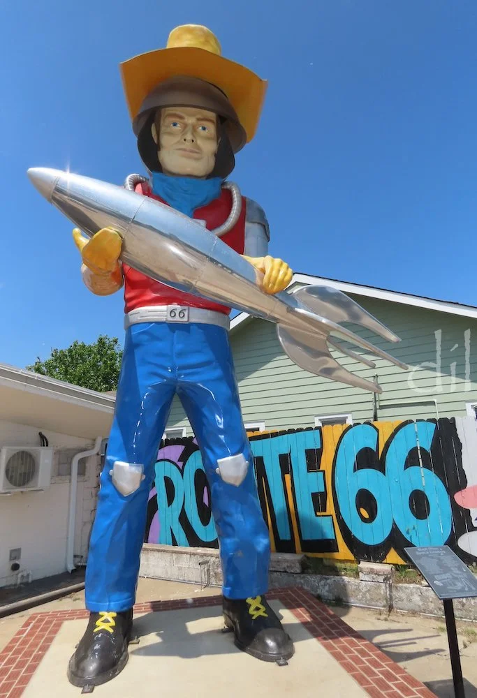
Operating out of a former gas station, Buck Atom's Cosmic Curios is one of the best souvenir shops on Route 66. Buck himself, a 21-foot-tall newly commissioned giant of a classic mold, holds a rocket ship and wears a cowboy hat perched atop a space helmet.
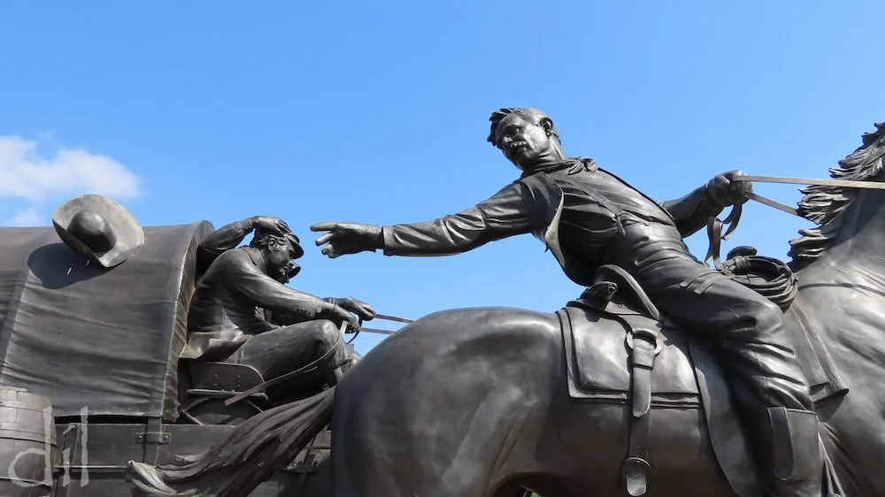
Created by noted sculpture artist Paul Moore, the Centennial Land Run Monument in Oklahoma City depicts the Land Rush of 1889. Featuring 45 bronze figures, the epic monument spans an area bigger than a football field.
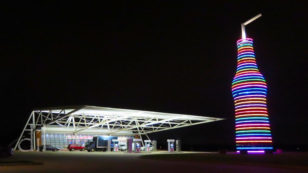
A 66-foot-tall soda bottle ringed with LED lights that continually change color makes Pops 66 in Arcadia, Okla., a must-see nighttime destination. If you can break the spell, step inside for a bottled pop of almost any conceivable flavor.
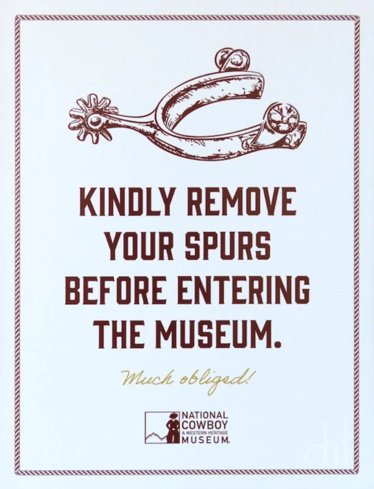
The collections of the National Cowboy & Western Heritage Museum pay tribute to the art and history of the American West. Each year the museum honors standouts in Western literature, music film and TV. Wild West writers earned seven of its Wrangler Awards.

Western film icon John Wayne (1907–79) donated signature movie memorabilia and Western art and artifacts to the museum. Raymond Kinstler's portrait of Wayne hangs beside the actor's film keepsakes in the museum's Hall of Great Western Performers.

A highlight of the museum collection, Paul Moore's bas-relief bronze "The Procession" depicts Pueblo Indians filing out of a Roman Catholic mission church during a ceremony. It feels as if the figures might emerge into the gallery.
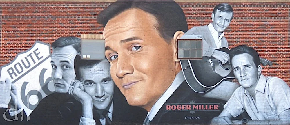
Singer-songwriter Roger "King of the Road" Miller (1936–92) grew up in Erick, Okla., which honors its native son with this kingly mural on the Mother Road. His 1965 hit single is tailor-made for Route 66, describing a hobo ("a man of means by no means") who revels in the freedom of the open road.
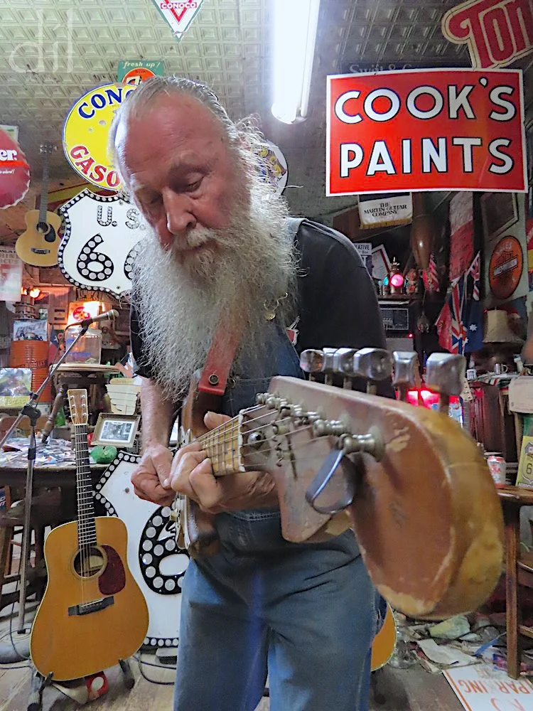
Erick is also home to self-proclaimed "Mediocre Music Maker" and "Hillbilly Hoarder" Harley Russell, owner of the Sandhills Curiosity Shop. Call ahead. If Harley is in, he'll play and sing you a song (strong language warning) for tips.
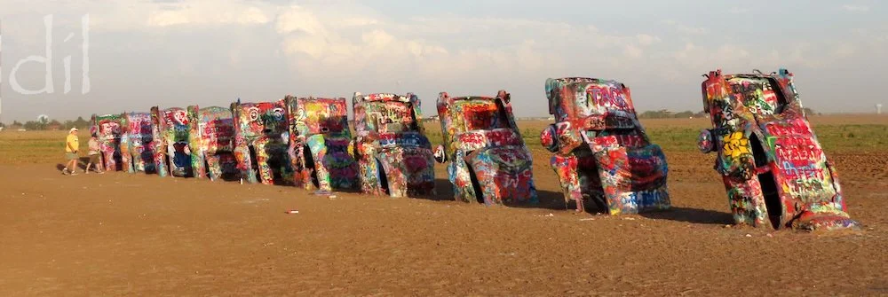
One of the world's most recognizable roadside attractions is Cadillac Ranch, just west of Amarillo, Texas, comprising a row of 10 Cadillacs (1949–63) buried nose-first in the ground in 1974 by a trio of avant-garde artist-architects. The installation has long been treated like a blank canvas, and visitors are encouraged to add their own messages in spray paint. The layers periodically slough off in heavy technicolor blankets.
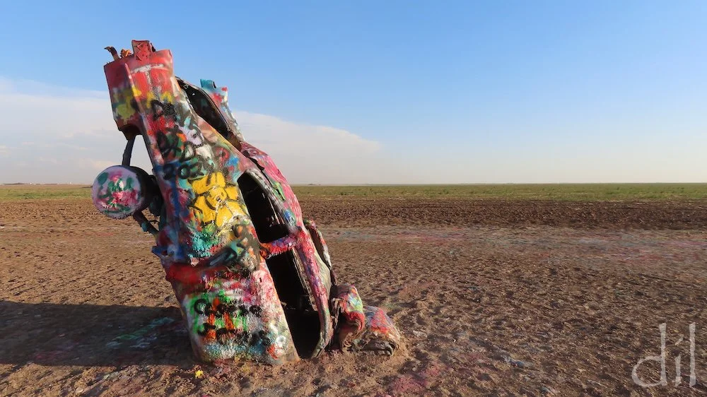
On a 2024 visit my father and I spray-painted the first Cadillac in line with our names, the year and a "Yellow Rose of Texas." We doubt it remained up an hour, but that's the ephemeral nature of the site.
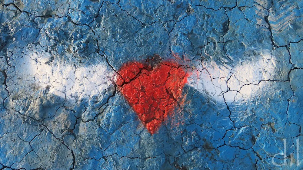
This winged heart, an enduring symbol of transcendent love, apparently took flight from the Cadillacs to light on the ground.
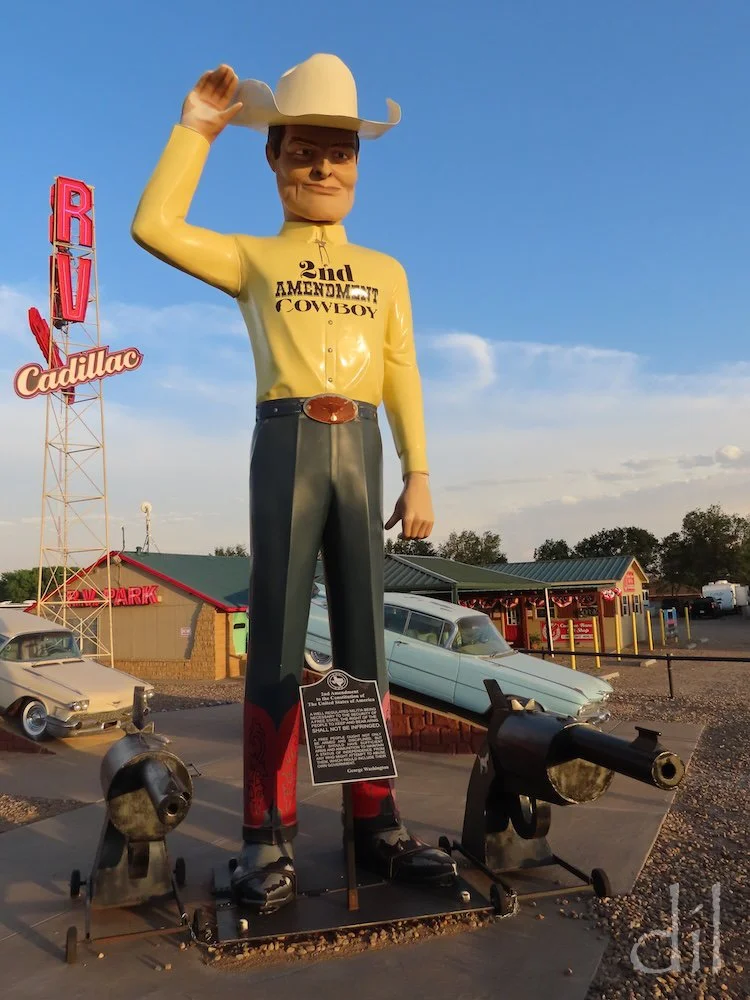
The Second Amendment Cowboy tips his ten-gallon hat toward Cadillac Ranch, just a mile down the road. At his feet are a pair of Colt revolvers and the full text spelling out Americans' right "to keep and bear arms."
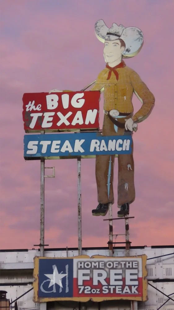
Another giant cowboy casts his gaze across Amarillo. The Big Texan's spread includes a Western-themed steakhouse and adjoining 54-room motel complex.
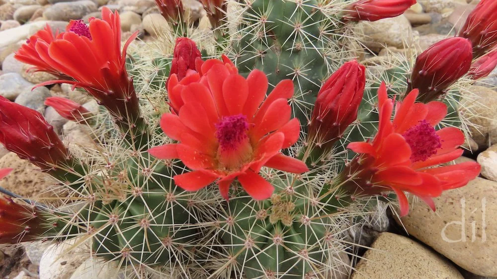
The aptly named scarlet hedgehog cactus is native to Palo Duro Canyon, a short drive due south of Amarillo. Charles Goodnight (1836–1929), trail boss and namesake inventor of the chuckwagon, ranched here. His story inspired the TV series Lonesome Dove.
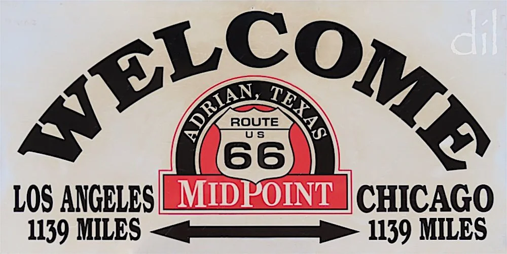
Adrian, Texas, may not be the precise midpoint of Route 66, but it's too close for neighbors to quibble and was too tempting a pitch for townspeople to pass up.
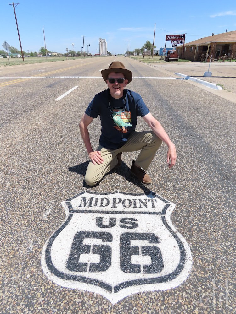
Thankfully, the midpoint sign and pavement marking shield lie on a quiet stretch of Route 66, as drivers regularly stop to pose for photos in the middle of the road.
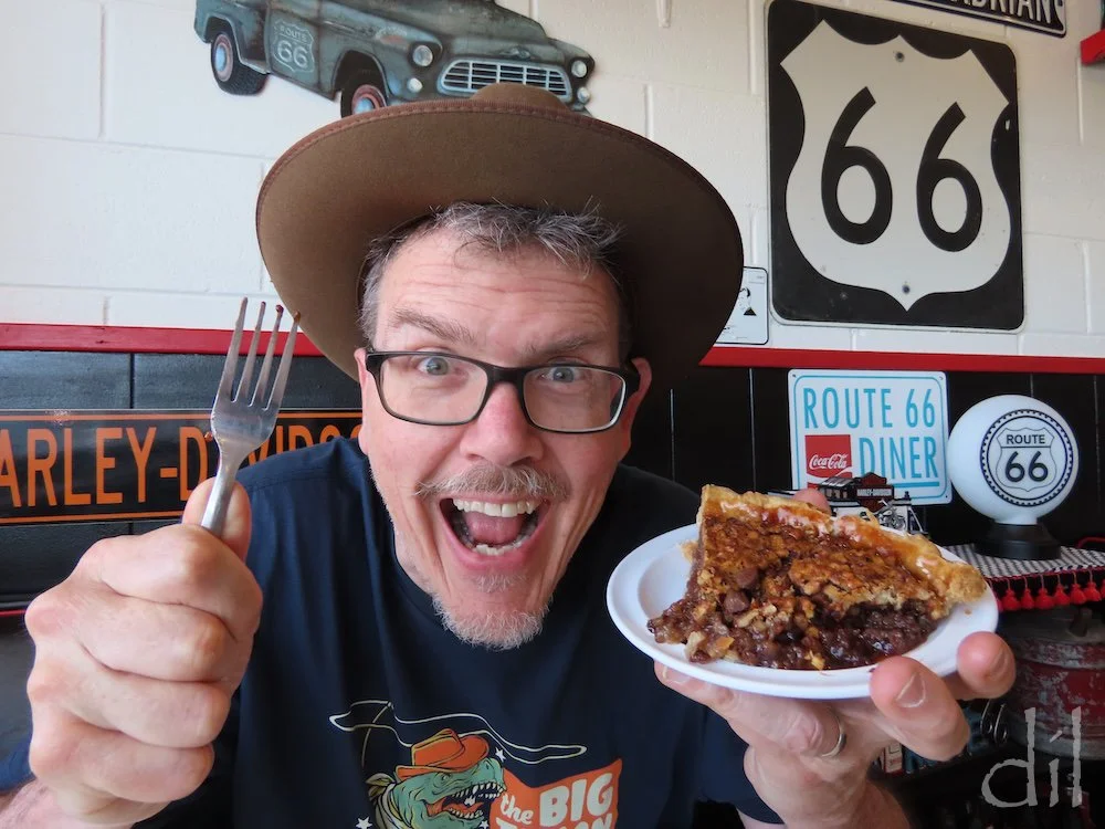
Another happy tradition roadies observe in Adrian is noshing on a slice of "ugly pie" at the Midpoint Cafe, directly across from the sign. The pie menu changes daily. Stroll off calories at the gift shop before hitting the road.
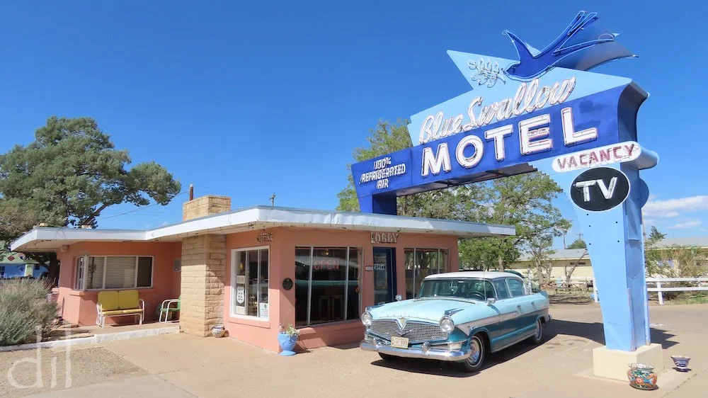
Often booked months in advance, the Blue Swallow, in Tucumcari, N.M., is widely considered the most authentic period motel on Route 66. Built in 1939, the L-shaped complex offers 14 beautifully restored rooms, many with attached garages, opposite the central lobby and owner's residence. Tours are available.
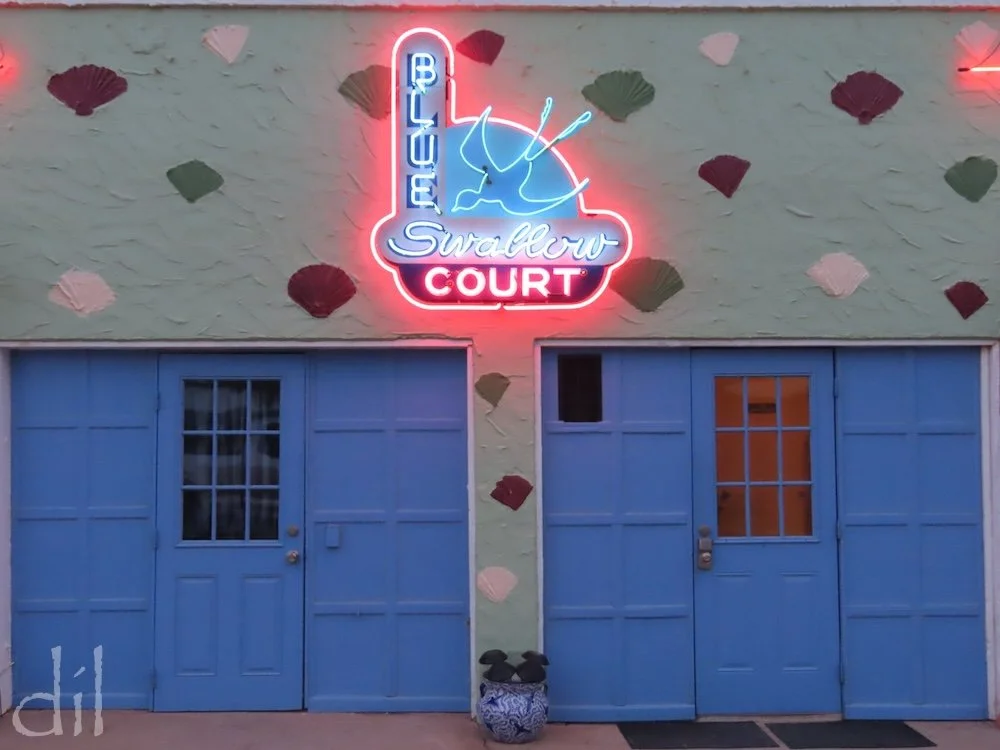
Most evenings in the courtyard of the Blue Swallow, guests recline by their doors in lawn chairs to bathe in neon and relax to tunes of the 1940s and '50s.
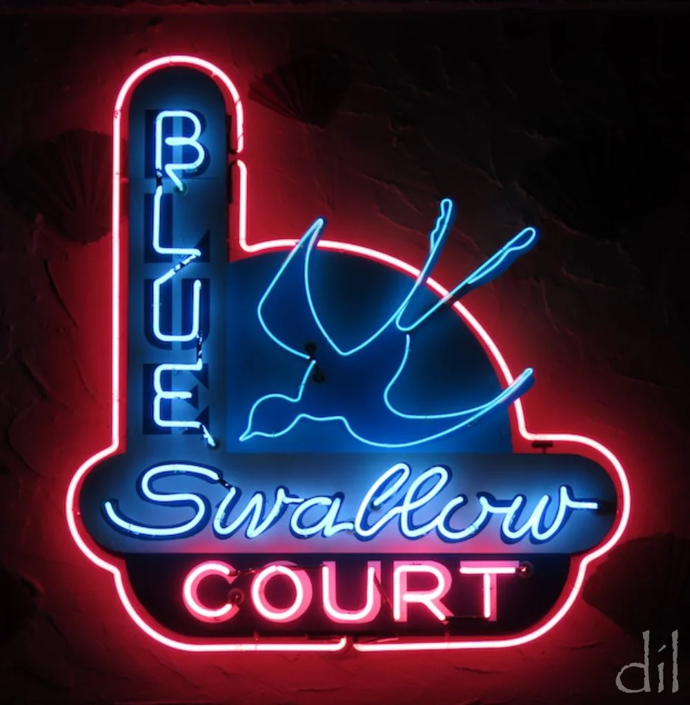
Tucumcari's abundance of neon signs inspired the makers of the Pixar film Cars. Whether overnighting or not, be sure to work in an evening stroll.
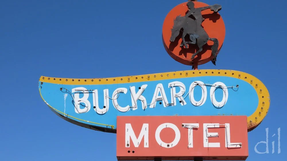
Even in daylight, Tucumcari's roadside attractions will have you leaning out the car window with camera in hand. Seemingly every block of central Route 66 Boulevard features a period motel, diner, marquee sign or mural. The Buckaroo dates from the early 1950s.
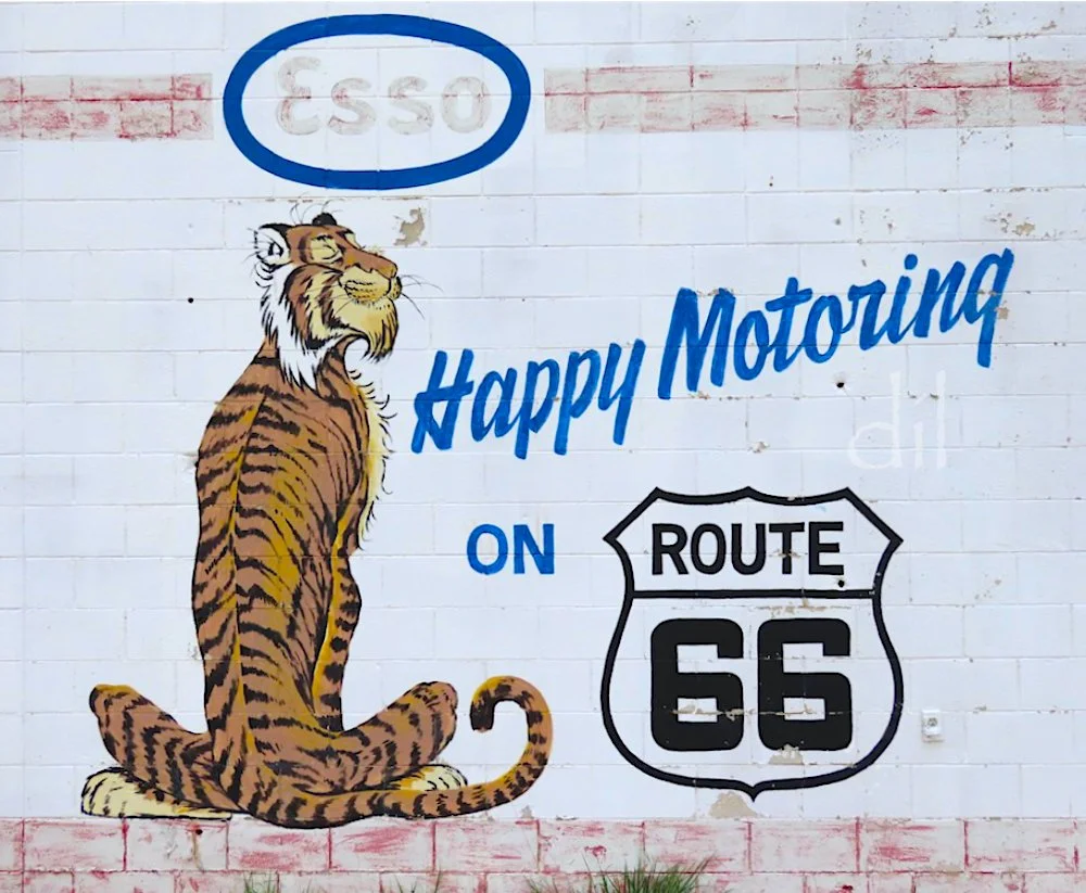
Route 66 and Esso are connected due to the onetime prevalence of the latter's gas stations along the Mother Road. Esso's popular "Put a Tiger in Your Tank" ads launched in 1959.
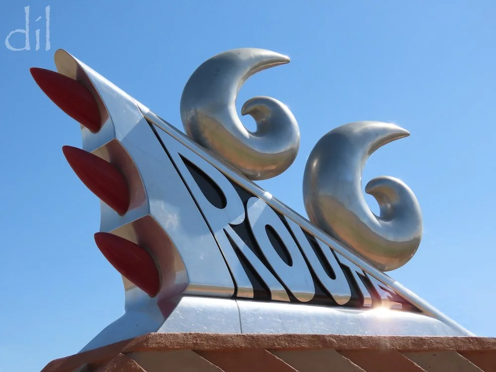
In 1997 New Mexico officials commissioned artist Tom Coffin to memorialize the legacy of Route 66. The result is the Mother Road Monument, outside the New Mexico Route 66 Museum, its shape echoing the taillights of a late-1950s Desoto.
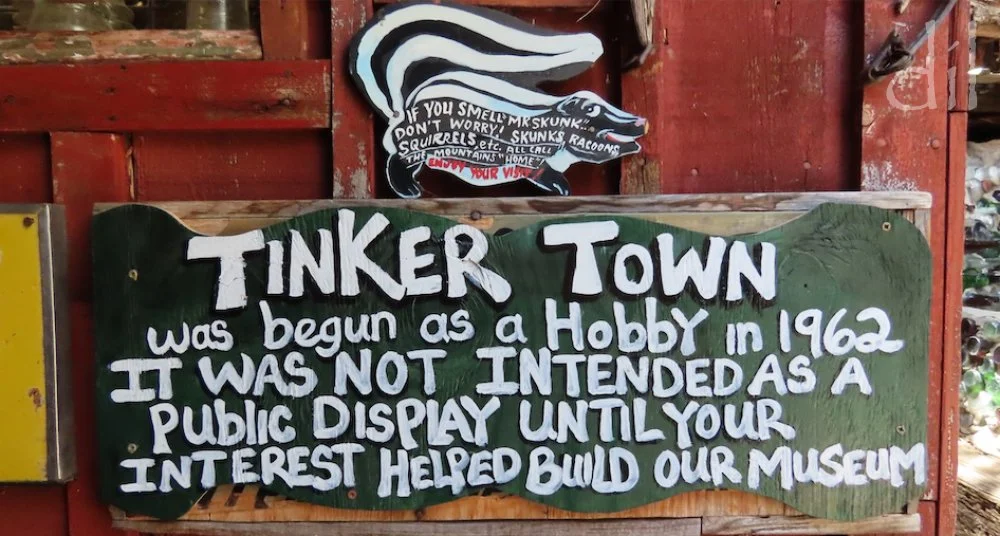
Self-taught folk artist Ross Ward (1940–2002) was the dynamo behind Tinkertown, a sprawling 22-room museum in Sandia Park, N.M. Among its eclectic oddities are hand-carved miniature dioramas, roomfuls of found objects, Ward's art Jeep (sheathed in pennies and bottle caps) and a 35-foot sailboat that circumnavigated the world. Ward crafted the building out of concrete and bottles. Budget at least an hour, though you'll never see it all.
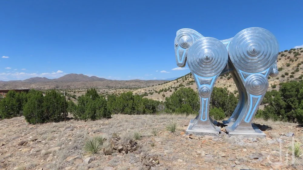
The Turquoise Trail National Scenic byway traces the hills between Tinkertown and Santa Fe, passing through the artist colonies of Golden, Madrid and Los Cerrillos. Just north of Madrid, this striking horse sculpture by Siri Hollander marks the entrance to the local artist's home studio.
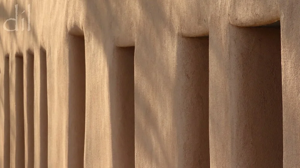
Route 66 originally passed through Santa Fe, whose art and architecture are unmistakable. It is home to scores of galleries and museums, including one devoted to Georgia O'Keeffe, whose modernist works redefined Southwest art. Santa Fe Plaza itself is a work of art, a canvas of adobe and sunlight.
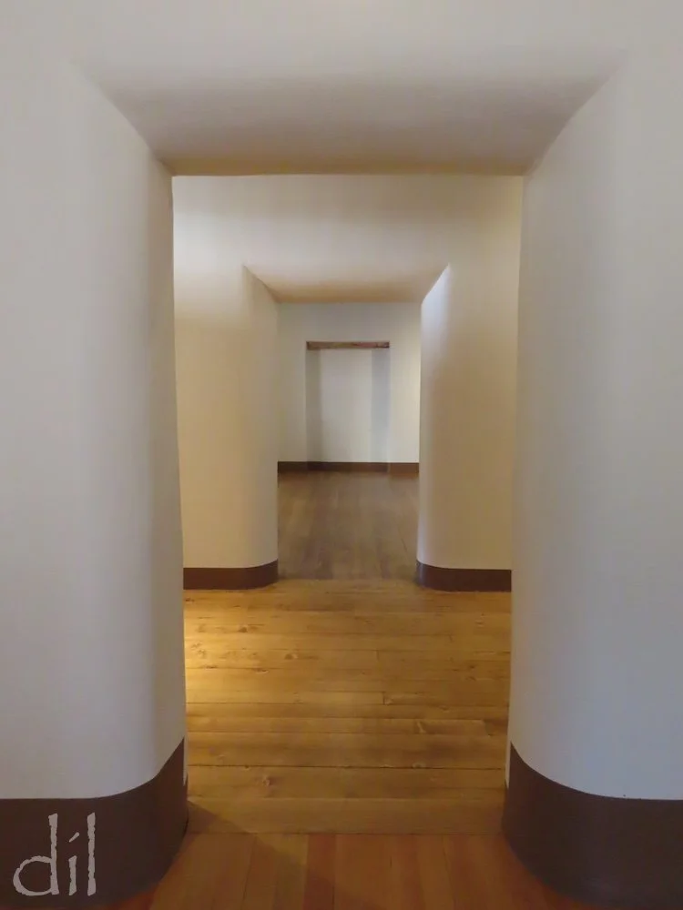
Fronting the plaza is the Palace of the Governors, which dates from the 1610 founding of Santa Fe, the oldest state capital in the United States.
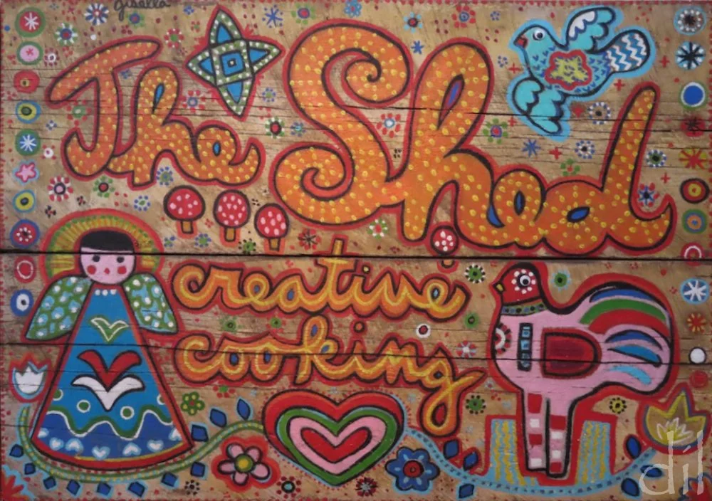
Santa Fe is also renowned for its Southwest cuisine, combining centuries-old culinary traditions and modern innovations. Be sure to try anything smothered in red chili sauce at The Shed — provided you can score a reservation at this local institution.
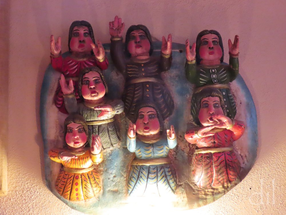
In Santa Fe one's eyes are never at rest. The Shed's walls, too, are graced with regional works. This painted clay Mexican folk art depicts seven women engaged in some form of ceremonial worship.
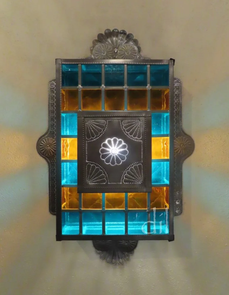
Across the plaza at La Fonda, the crown jewel of Santa Fe's luxury hotels, every detail, down to the doorknobs and wall sconces, is a work of art.
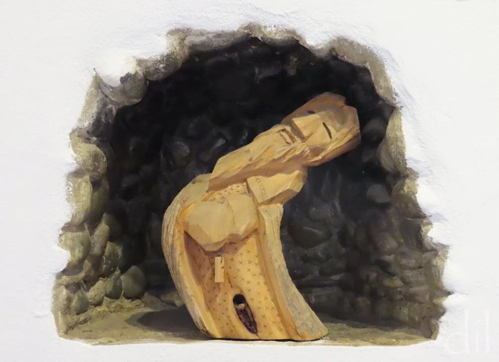
A day trip north of the Mother Road, the Chimayó Valley and Taos beyond are also steeped in regional artistic traditions. This carved fellow graces a nook at the entrance of Rancho de Chimayó Restaurant.
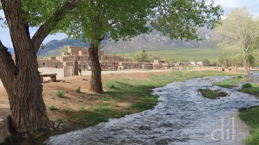
This timeless scene from the Río Pueblo de Taos, fed by snowmelt and springs from the neighboring Sangre de Cristo Mountains, captures the multistory adobe settlement that predates Spanish arrival in the New World by centuries. Lose yourself here for a day.
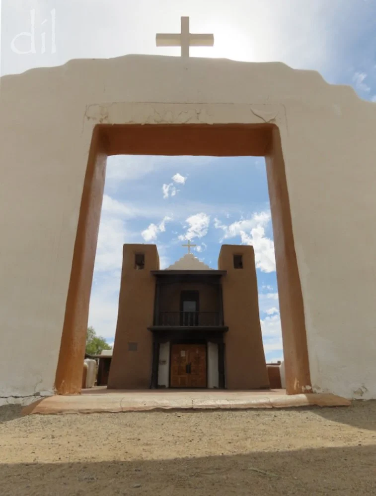
At the heart of Taos Pueblo is the 1850 adobe mission church of San Geronimo de Taos. The Spanish built the first church here in 1620. It was razed amid the 1680 Pueblo Revolt, its replacement destroyed during the 1846–48 Mexican War.
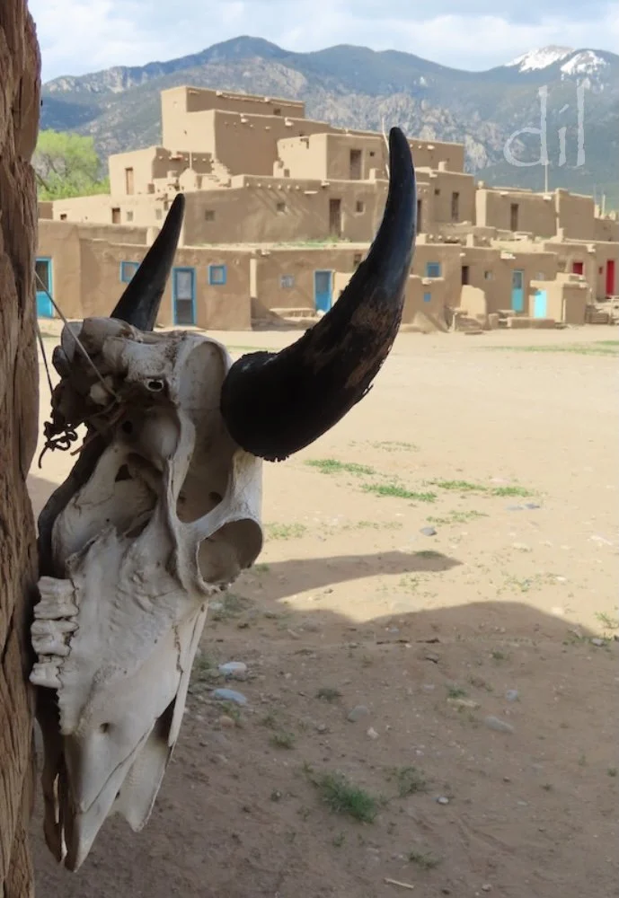
The pueblo itself dates from the late 13th to early 14th century. Up to 150 people make their home in the historical pueblo, while the total population of the 95,000-acre reservation hovers around 4,500.
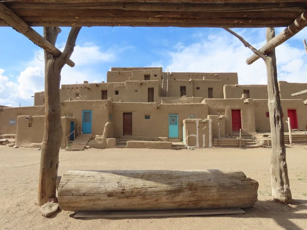
The largest surviving Pueblo structure, Hlaumma (North House) was originally built for defense, with walls several feet thick and ladder-only access to hatchways in the roofs. The colorful doors and multiple windows are more recent additions and make it highly photogenic. However, life here isn't easy, as electricity and running water are prohibited in pueblo homes.
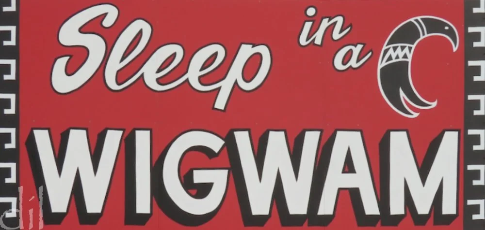
Of the myriad roadside ad gimmicks along Route 66 — including the classic multi-sign Burma Shave pitches and fiberglass giants of every size and description — perhaps none is more conducive to hitting the brakes than these signs for the chain of seven Wigwam Motels that once stretched from Florida to California. Three survive, two on Route 66.
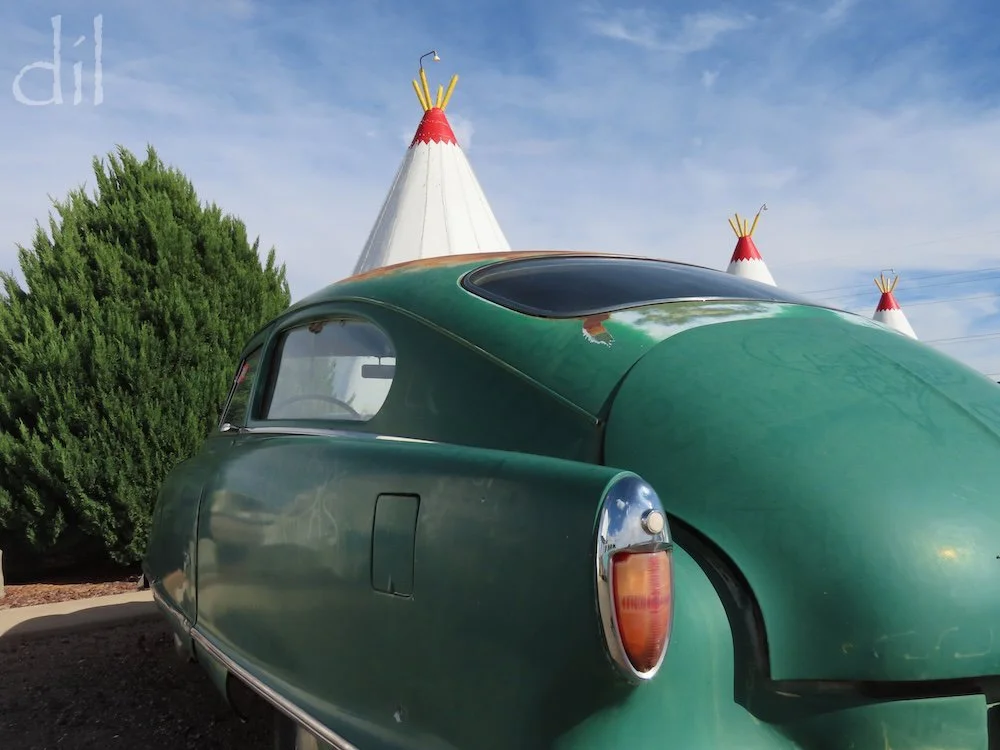
Wigwam Motel No. 6, in Holbrook, Ariz., was built in 1950 to cater to Route 66 travelers and those bound for the nearby Petrified Forest, Painted Desert and/or Meteor Crater. Fifteen 32-foot-tall steel-and-concrete "wigwams" (actually tepees) flank the roadside lobby on three sides. Each room has air conditioning and a bathroom with shower. Vintage cars dot the parking lot, enhancing the campy charm of this Route 66 gem.
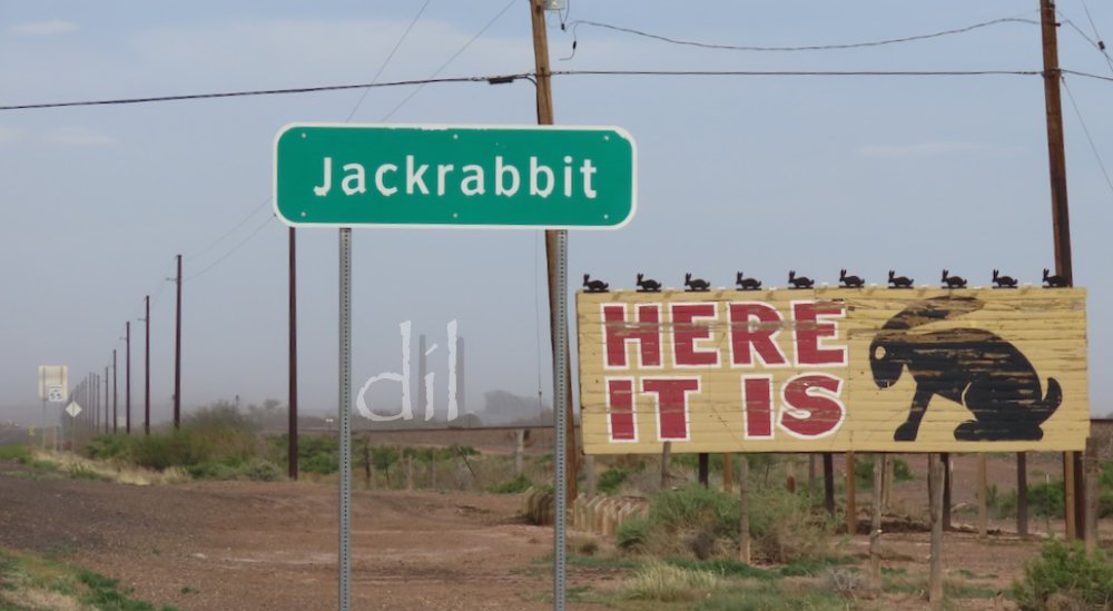
Another memorable ad campaign saw hundreds of billboards posted at regular intervals along Route 66 from Missouri to Arizona all bearing the silhouette of a jackrabbit. Today only the last billboard survives, but the surprise it conceals (spoiler alert!) remains a joy.
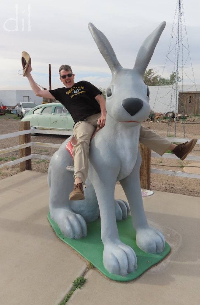
Ride 'em, cowboy! That's a 12-foot-tall fiberglass rabbit waiting for you at the Jack Rabbit Trading Post in Joseph City, Ariz. Your name wouldn't be Harvey, by any chance?
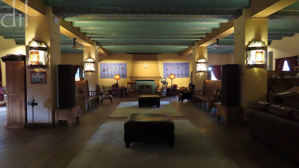
To experience the era of luxury travel in the early days of Route 66, book a room at La Posada, built in 1930 beside the Atchison, Topeka & Santa Fe station in Winslow, Ariz. The inn was designed by noted Harvey House and AT&SF architect Mary Jane Colter. Famed for her blend of Spanish Colonial and Mission styles with American Indian touches, Colter considered La Posada her masterwork. Her influence continues to inform Southwestern architecture and interior design.
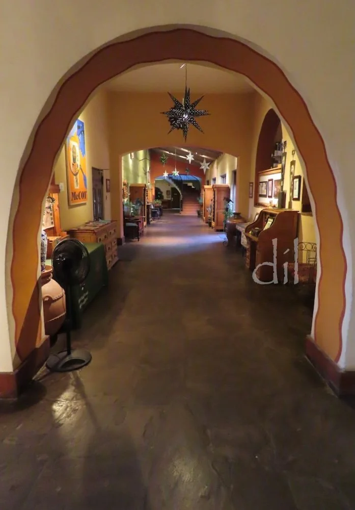
Colter left her mark throughout La Posada, with its airy ceilings, dramatic natural and artificial lighting, earthy color palette and efforts to bring the outdoors inside.
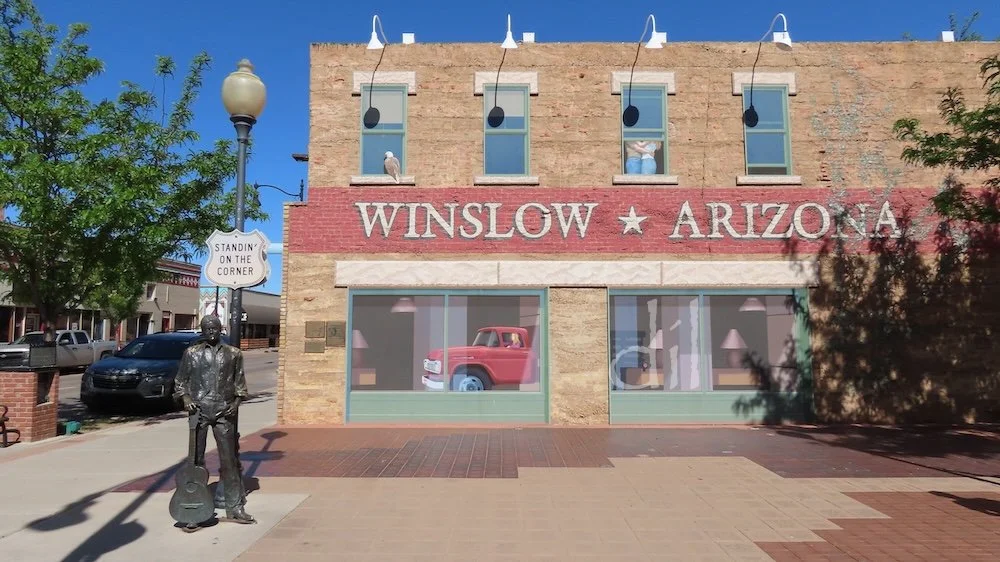
The railroad may have made Winslow, but by the end of the 20th century the town had become inextricably tied to the following lyrics from the Eagles' 1972 hit song "Take It Easy": "Well, I'm a-standin' on the corner in Winslow, Arizona, with such a fine sight to see. It's a girl, my Lord, in a flatbed Ford slowin' down to take a look at me." Town boosters took full advantage and in 1999 opened Standin' on the Corner Park (above) in artistic homage to the song.
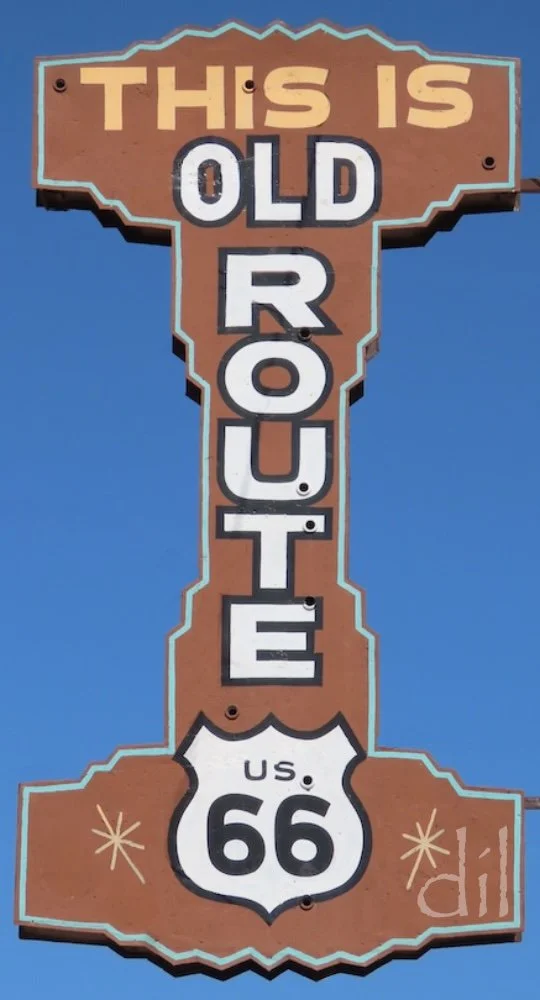
On the road again, look for this classic roadside sign on a freestanding pole. The mid-century modern styling and national park brown color speak to that time and place.
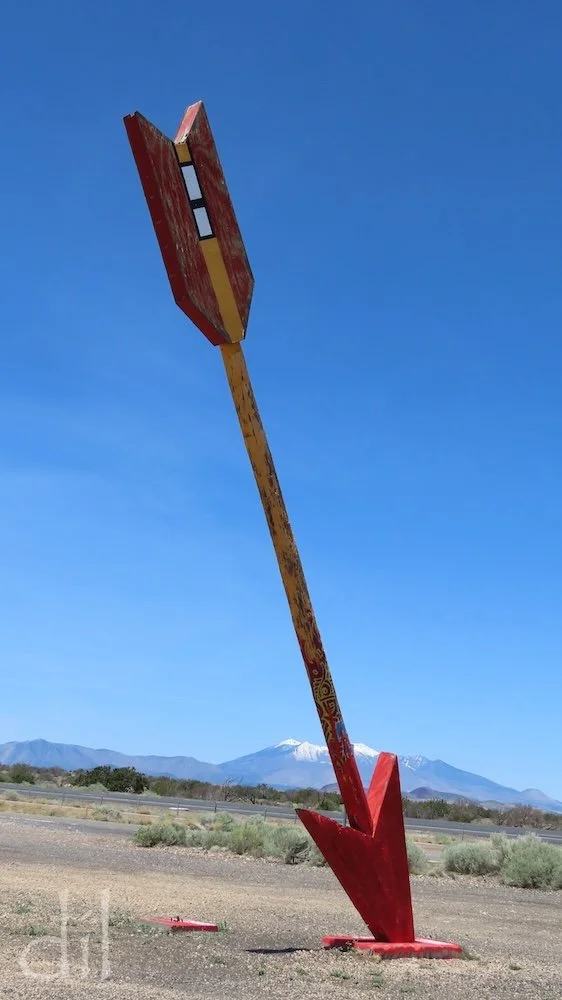
Sadly, only one of the namesake missiles remains standing at the ruins of the Twin Arrows Trading Post, midway between Winslow and Flagstaff. Its damaged twin flew off for parts unknown.
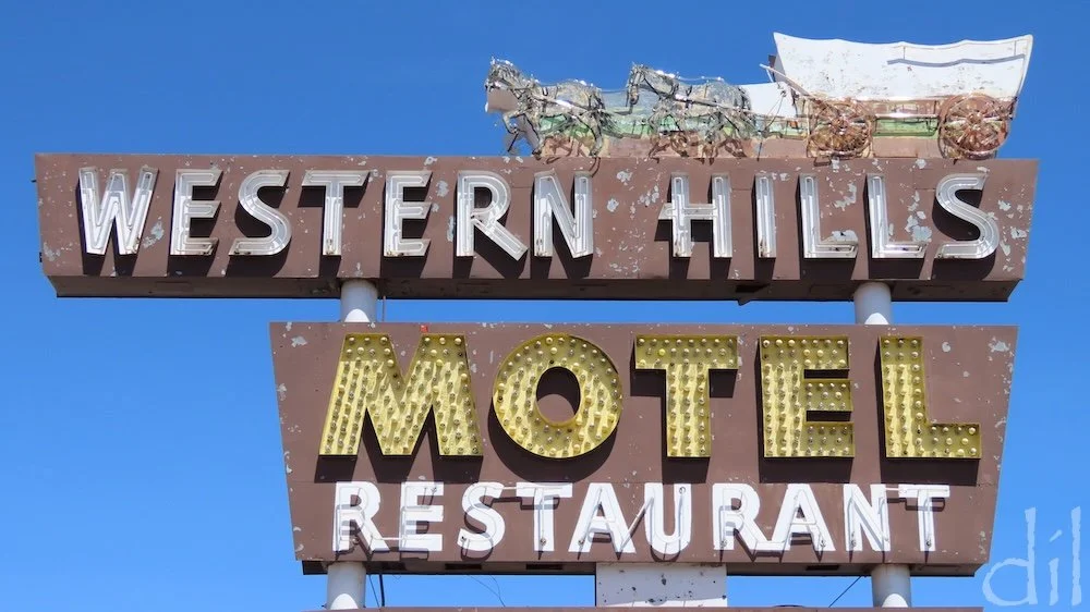
Route 66 kitsch in the tourist-friendly Grand Canyon gateway town of Flagstaff could fill a photo gallery of its own. You'll suffer whiplash in your efforts to capture it all. Above is one of the older examples, the 1950 Western Hills Motel sign, capped by a neon prairie schooner and horses.

At last a giant who retains his original occupational status. This madly grinning Paul Bunyan, outside Walkup Skydome at Flagstaff's Northern Arizona University, grips a broadax instead of grill implements, a rocket, hot dog or bucket of fried chicken.
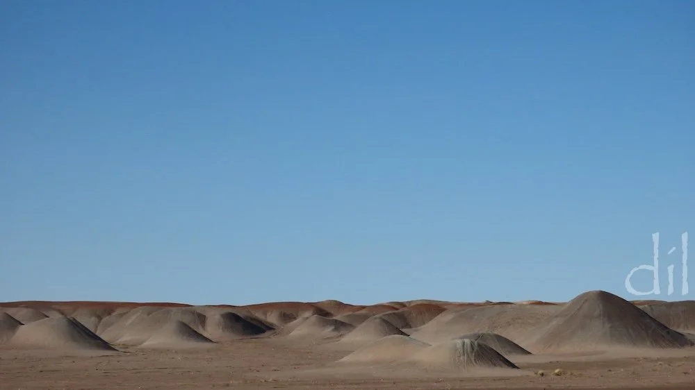
At this juncture on the Mother Road, northern Arizona's natural wonders demand a detour. En route you'll drive through the mudstone-and-ash Gray Hills, north of the trading post town of Cameron. They're absent from most maps, and they'll be in your rearview before you can blink.
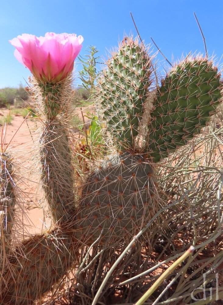
An amusing pastime during desert crossings is to look for figures among the prickly pears, much like looking for sheep in clouds. This cluster in the Navajo Nation calls to mind a jackrabbit on an Olympic torch run — or do you see something else?
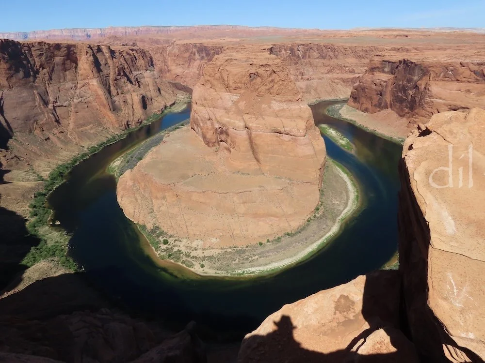
Up near the Four Corners (the shared border of Arizona, Utah, Colorado and New Mexico) is Page, jumping-off point for a host of activities and natural wonders. Just south of town is this spectacular overlook of Horseshoe Bend on the Colorado River. Watch your step, as there are few railings. Linger long enough and you'll spot a boat plying the river, seemingly in miniature.
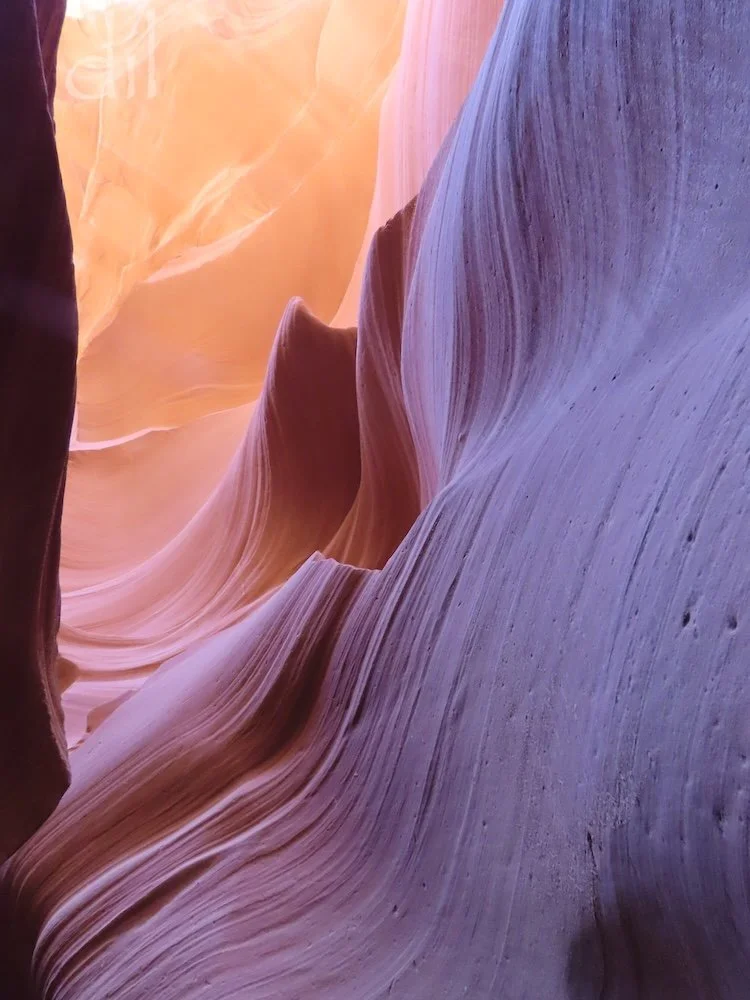
East of Page is Antelope Canyon, a cathedral of red rock and light sculpted for millennia by wind and water. The Navajo Nation offers guided walks through both Upper and Lower Antelope (pictured here).
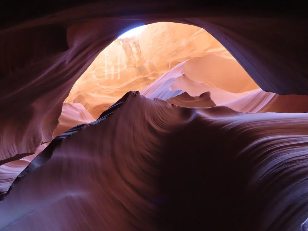
At the heart of Lower Antelope is this feature dubbed The Eye, images of which have graced countless travel guides, coffee table books and art galleries, spreading the canyon's fame internationally. Go around midday, when the sun sets the stone afire, ranging through all shades of yellow, orange, red, brown and purple. Book your tour weeks in advance for the best time slot.
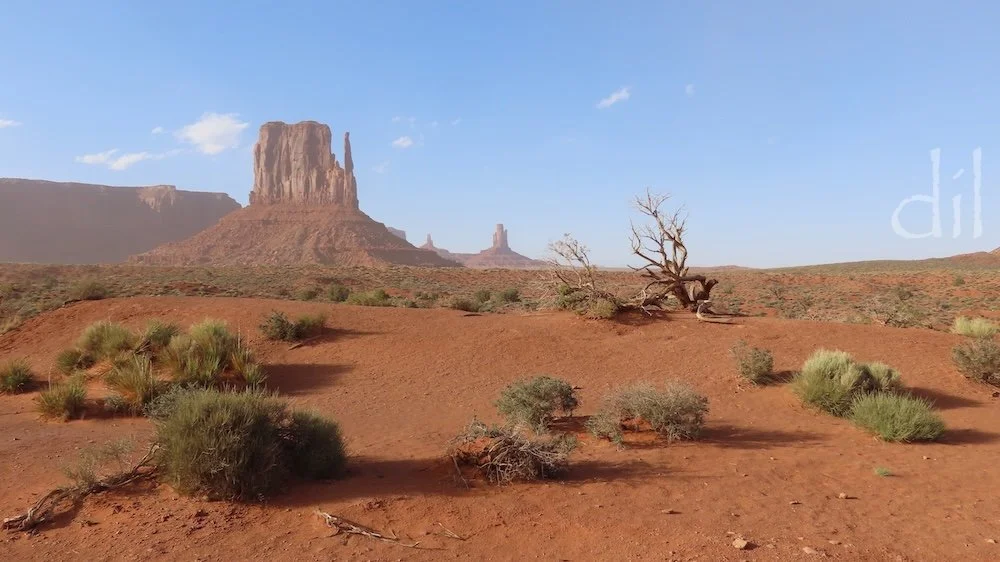
Granted, a three-hour drive off Route 66 is stretching the bounds a bit, but Monument Valley, crown jewel of the Navajo Nation in northeastern Arizona, is worth going twice as far to see. Straight off visitors are treated to views of the Mittens, perhaps the most filmed and photographed rock formations in history. That's West Mitten above, which seems to have misplaced its other mitten.
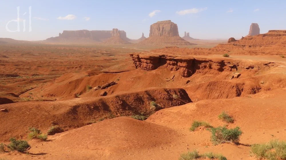
Four-time Oscar-winning director John Ford put Monument Valley on the map with the nine Westerns he filmed there, five starring John Wayne and most set during the Indian wars. Ford hired Navajo extras to play the various Apache, Cheyenne or Arapaho warriors. The Navajos honored the director by naming the distinctive outcrop at center above John Ford Point. In Ford's 1956 classic The Searchers, Wayne's character Ethan Edwards lowers Martin Pawley (Jeffrey Hunter) by hand from the point.
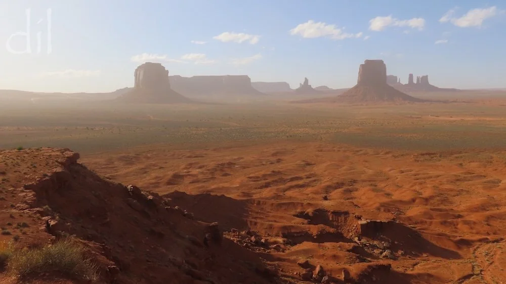
The deeper you drive into Monument Valley, the further back in time you're transported. There are no modern reference points in sight from this unnamed overlook, which afforded the perfect vantage of a dust storm sweeping through. No wonder Ford kept returning to film here.
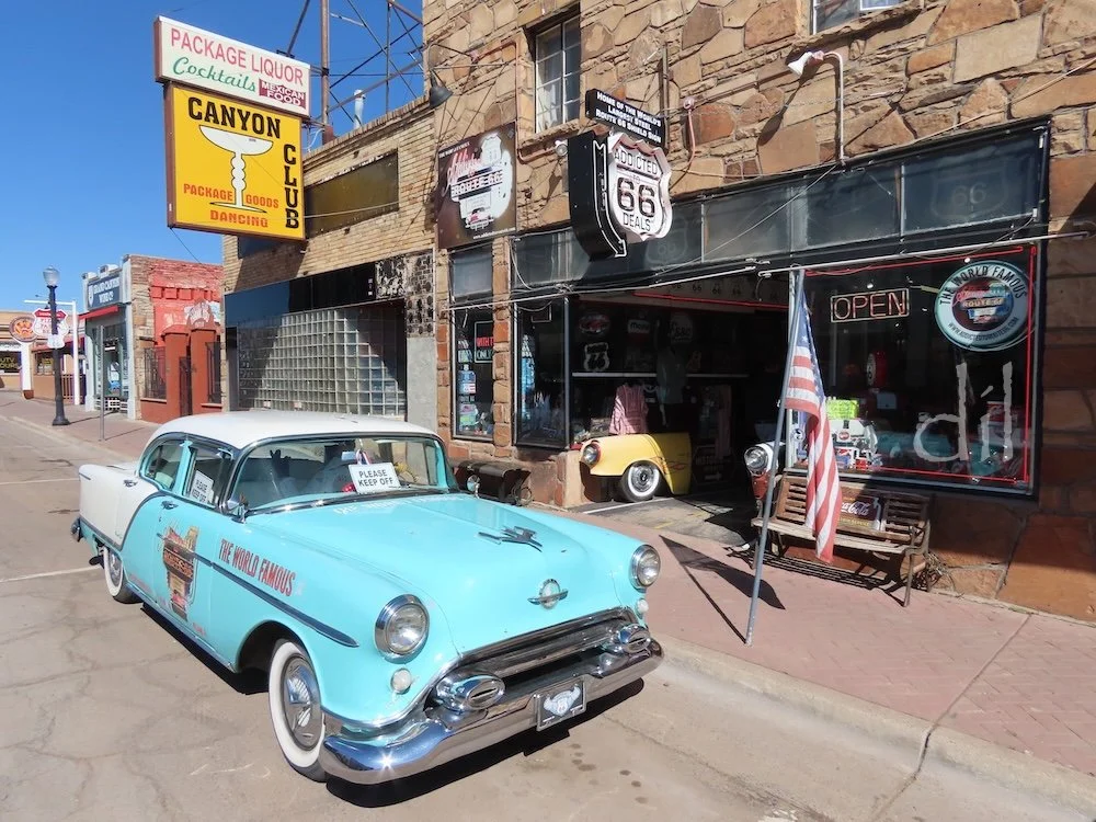
Williams, Ariz., is something of a twofer, as both the trademarked "Gateway to the Grand Canyon" and the last town on Route 66 to be bypassed by an interstate. Before that happened, the city negotiated for three exits on I-40, thus securing its future and prompting efforts to preserve much of its signage, architecture and road culture. Neon lights up its streets at night.
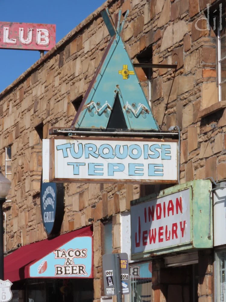
Roadies and photographers are in heaven on Williams' stretch of Route 66, which uniquely splits into two one-way stretches through town. Drivers soon adopt the classic cruising pattern, round and round, taking in the sights.
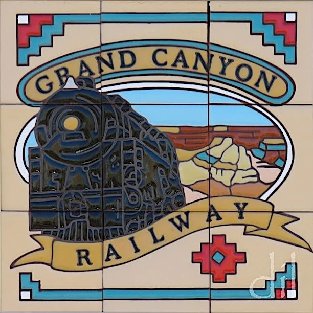
Williams is also the southern terminus of the 64-mile Grand Canyon Railway, built in 1901 as a tourism branch by the Atchison, Topeka & Santa Fe. The AT&SF was instrumental in the creation of Grand Canyon Village, at the north end of the line. Be forewarned that "train robbers" regularly strike in Williams.
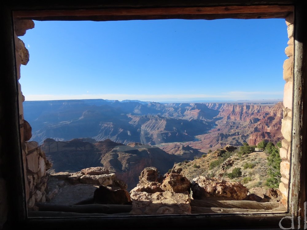
This framed view of the Grand Canyon is from the patio at Hermit's Rest. Built by Mary Colter in 1914 as a stagecoach stop on the South Rim, it serves today as a gift shop and refreshment stand. Colter's signature touches include a mounted Spanish mission bell at the entrance, stonework that blends into the natural rock, rustic furniture and American Indian decorations. The interior centers on a monumental fireplace alcove.
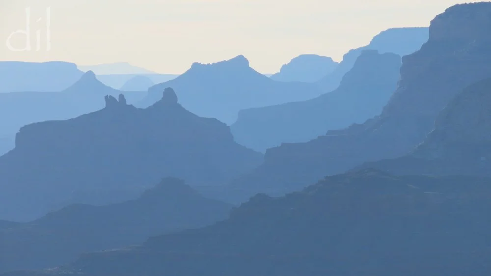
The Grand Canyon is 10 to 12 miles across from South Rim to North Rim and a mile down to the Colorado River. Its immensity is virtually impossible to describe to the uninitiated. Most photos only flatten its scale into a painterly representation. Visitors to mountains often describe how haze makes ridges appear like torn construction paper of successively lighter shades, and perhaps that is the only way to effectively convey the magnitude of the canyon.
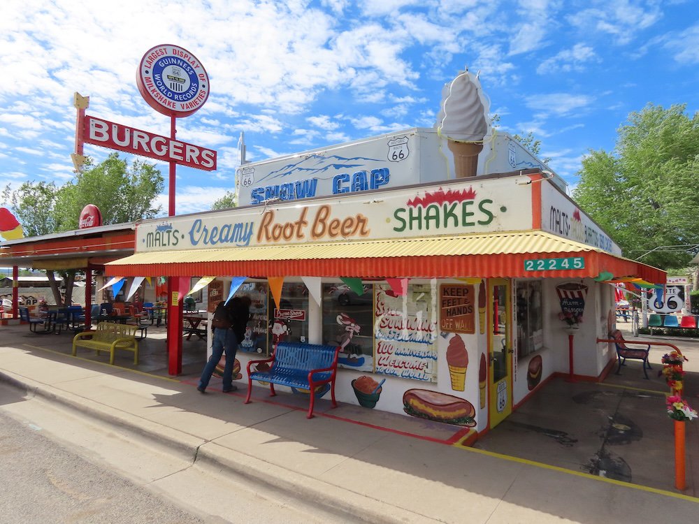
The Delgadillo family enterprises in Seligman, Ariz., speak to determination and highlight the resilience of free enterprise. Angel Delgadillo opened his barber shop here on Route 66 in 1950, brother Juan the Snow Cap Drive-in (above) in 1953. When I-40 bypassed town in 1978, the brothers formed an association and lobbied the state for historic recognition. Daily busloads of curious tourists attest to their success story.
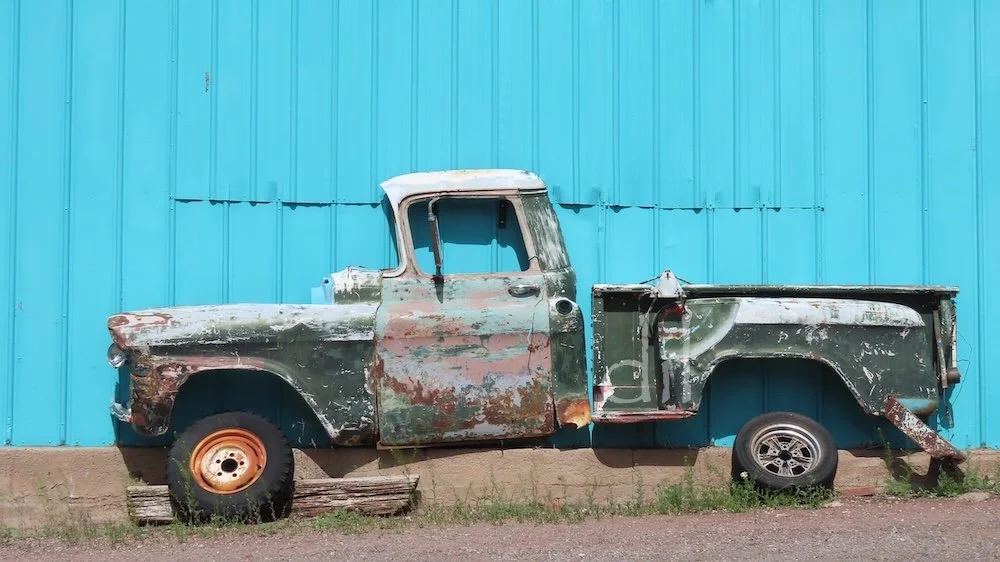
The Snow Cap property is a riot of schticky signs, vintage cars and neon, and that fun-loving style has spread throughout town. Across the street you'll find this slice of a vintage pickup welded to the side of the Road Relics antique shop. Other discoveries await.
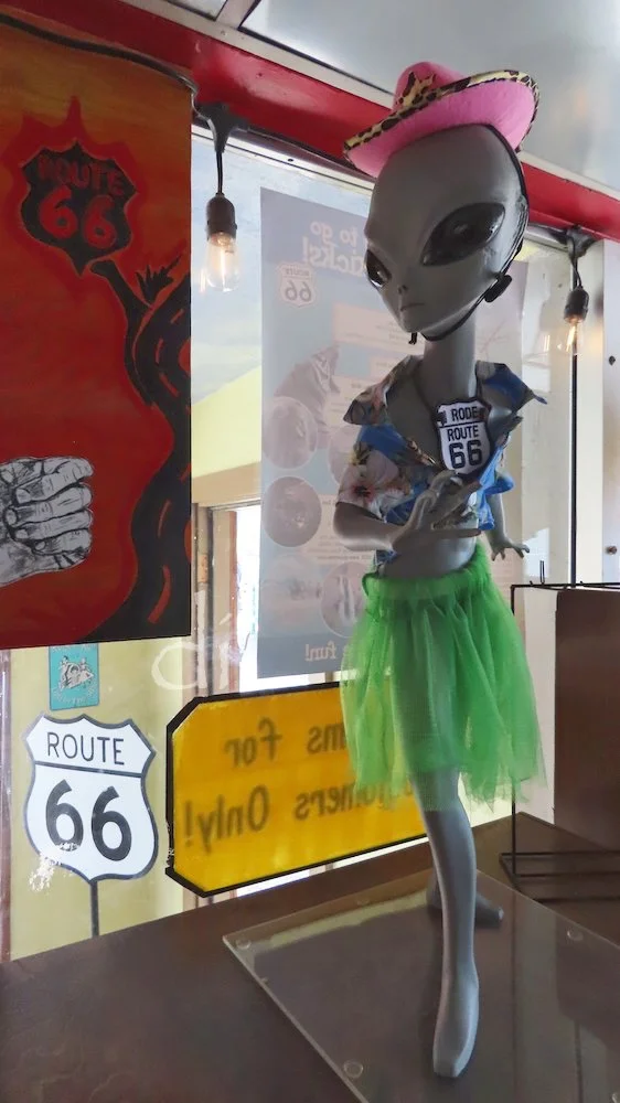
A few blocks west is the Copper Cart, another trove of vintage cars and eclectic Route 66 souvenirs. In the desert Southwest a nod to UFO culture is inevitable.
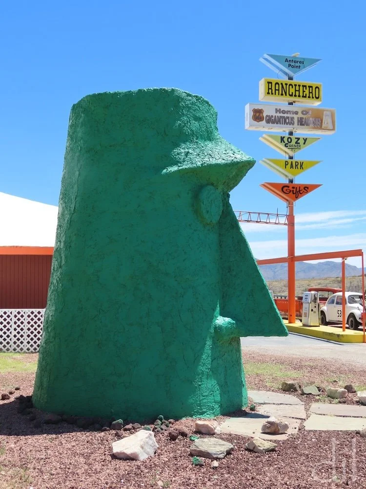
West of Seligman, Route 66 and I-40 part ways. Sixty miles out on the Mother Road is the Antares Point Visitor Center, another oasis of mid-century Americana. Here you'll find Giganticus Headicus. Who needs Easter Island?
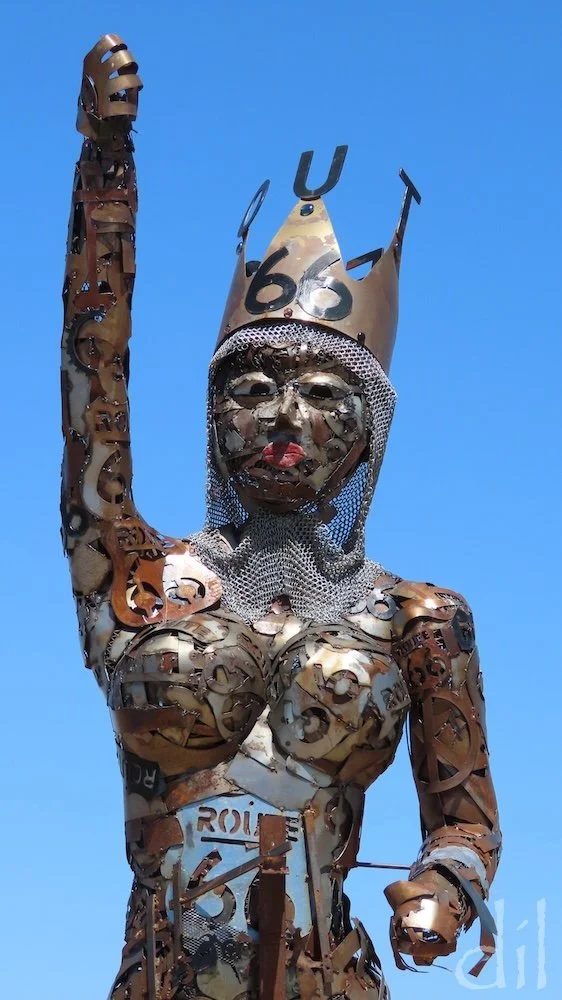
Rising above the vintage cars at Antares is the welded Guardian of Route 66. Resident artist Gregg Arnold is always adding new objects to the Americana cache.
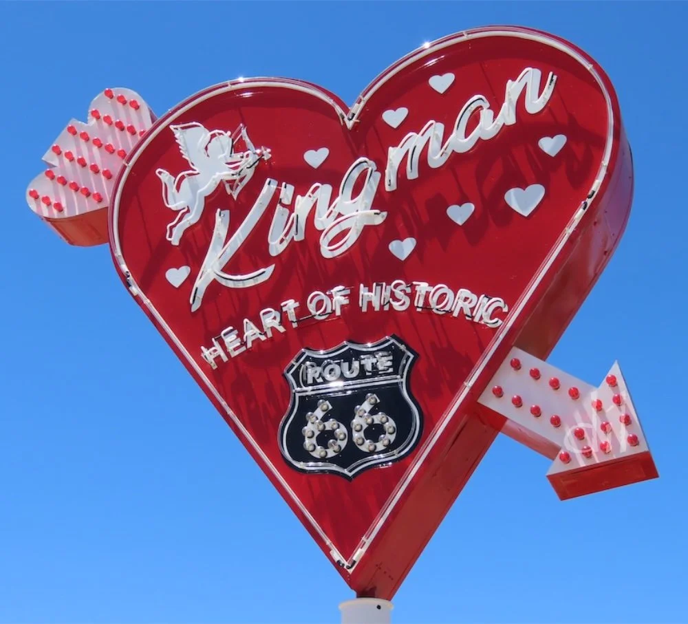
Kingman predates Arizona statehood and has remained prosperous, so its Route 66 highlights are a bit more polished, including several museums, vintage motels and the bustling, 1950s-themed Mr. D'z Route 66 Diner, operating out of a 1939 gas station.
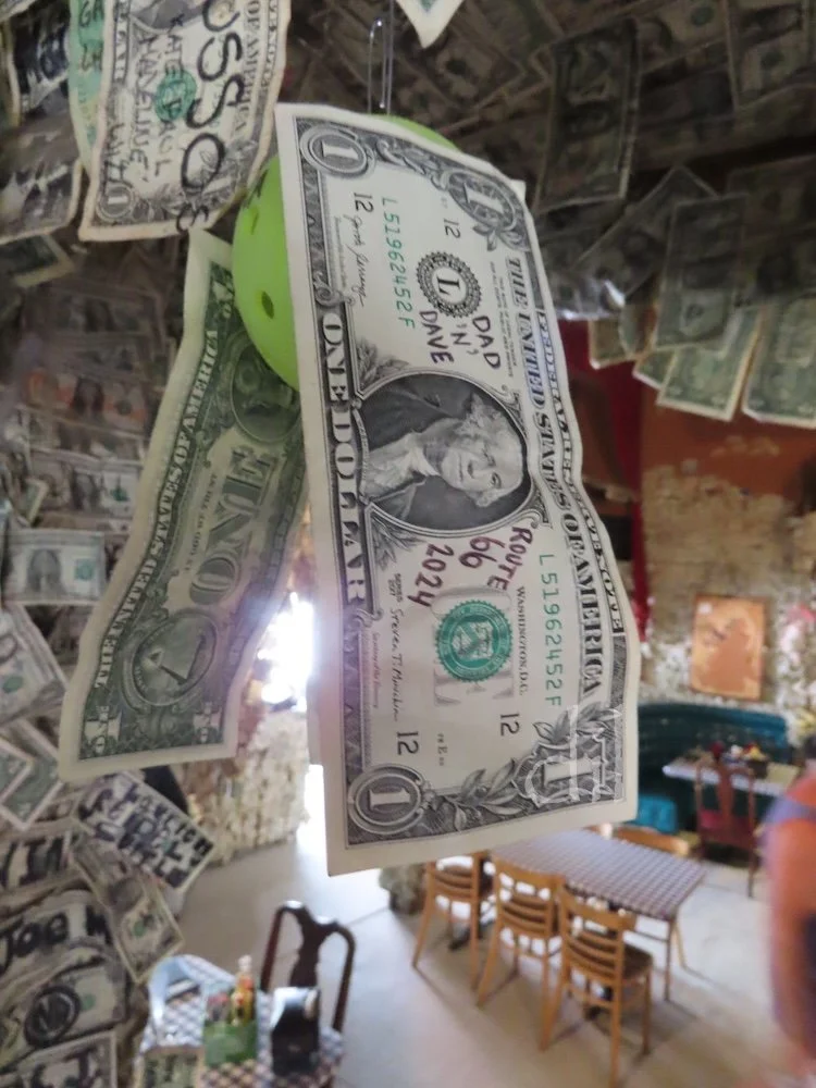
Oatman, Ariz., high up past sidewinding roads, is a must-see Route 66 highlight. The ramshackle town is all schticky signs and wild donkeys, its hotel restaurant (above) wallpapered in dollar bills. Don't ask, just go!
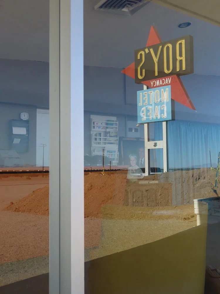
A Route 66 landmark since 1938, Roy's Motel & Cafe, in Amboy, Calif., was a mandatory stop in the Mojave Desert. Today it sells gas, souvenirs and snacks. The original retro, glass-walled motel office is eerily nostalgic.
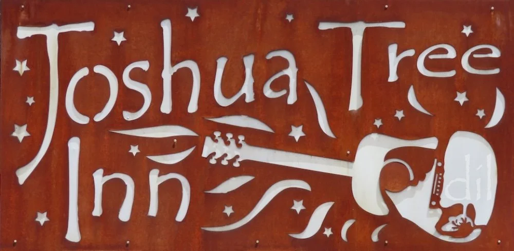
An hour south of Route 66, Joshua Tree pays back the detour with dividends. Opened in 1950, the intimate, hacienda-style Joshua Tree Inn is a great place to start. A favorite of musicians and actors, the inn enshrines singer-songwriter Gram Parsons, who died in Room 8 in 1973. From there it's a short drive to explore town or neighboring Twentynine Palms. Allow a day for a ramble through the national park, popular among boulder climbers and admirers of the namesake Seussian tree.
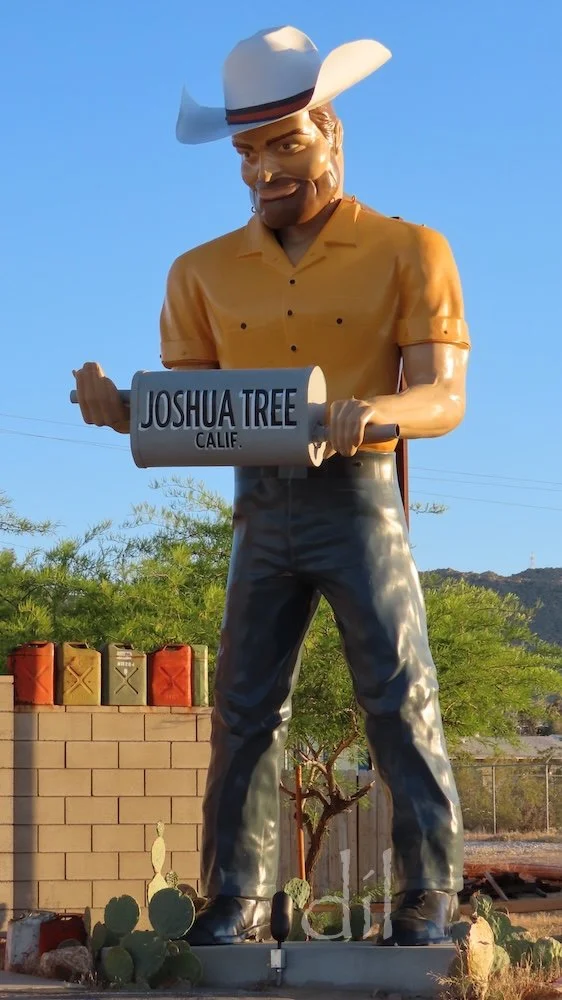
Rescued from the scrap heap, Big Josh the muffler man cowboy, stands outside The Station Joshua Tree souvenir shop, itself housed in a 1949 gas station.
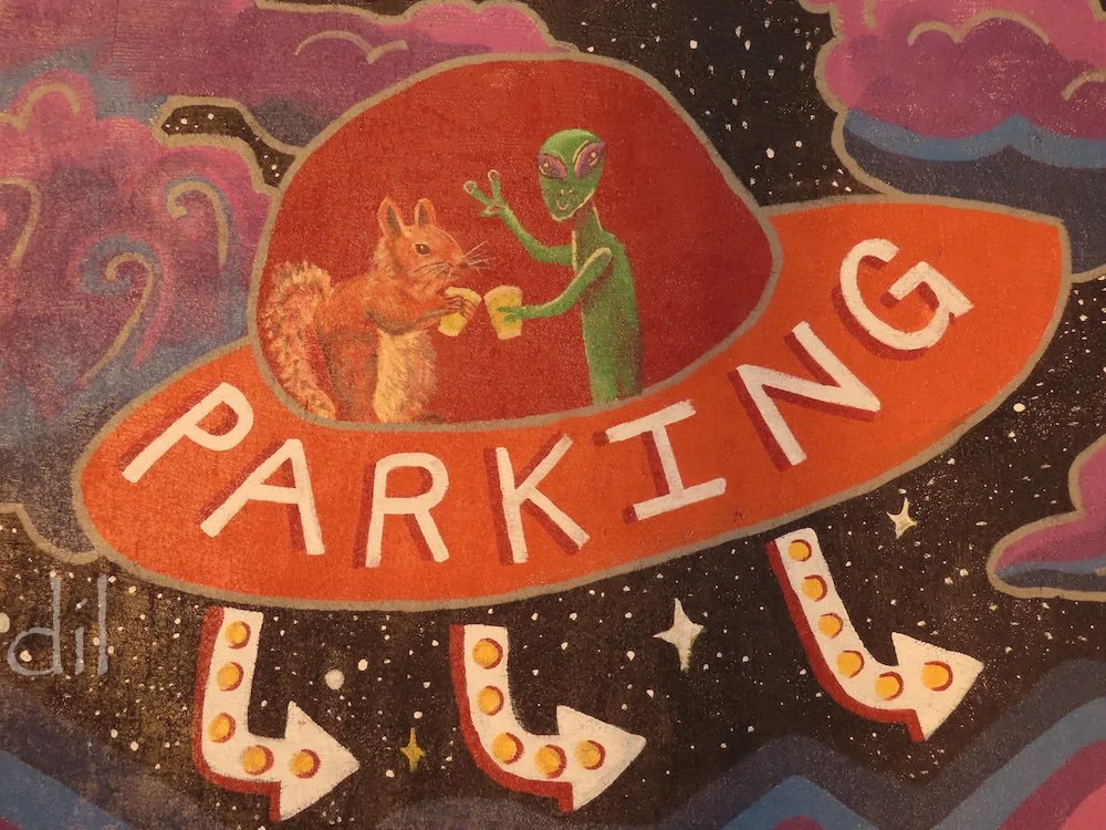
Only in UFO country would a wall mural center on a ground squirrel toasting an alien. The bushy-tailed one is the mascot of Grnd Sqrl, a gastropub/taphouse in Twentynine Palms that is well worth an intergalactic visit. Cheers!
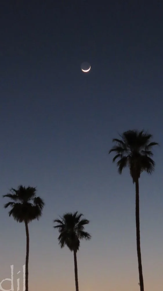
Twentynine Palms was named for palms ringing the original oasis. Palms survive, and town is an oasis of hotels, motels, bars, restaurants and gift shops.
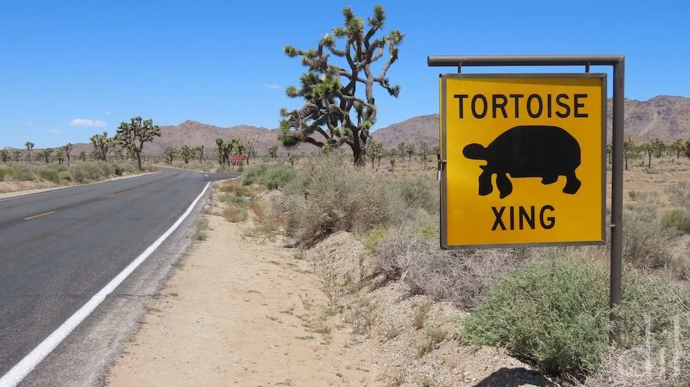
Why did the desert tortoise cross the road? Fact is, you'll be fortunate to spot one in Joshua Tree National Park, as they spend most of their lives burrowed underground to escape either scorching days or frigid nights. Slow down, anyway as the Joshua trees (actually giant yuccas) and jumbled boulder clusters are each fascinating in their variety.
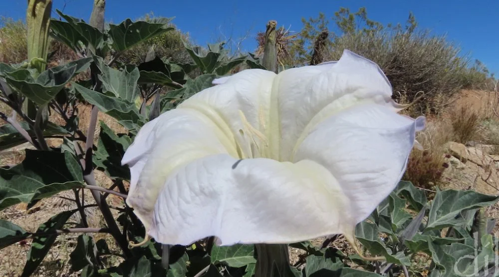
This desert beauty is the sacred datura, or moonflower. The common name derives from its tendency to bloom overnight to lure in such pollinators as the sphinx moth and perpetuate its species. Enjoy its sweet fragrance from a respectful distance, however, as it is highly toxic to humans and animals, causing delirium and even death.
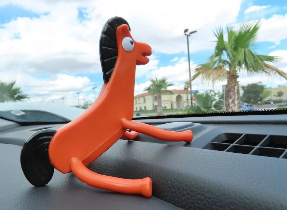
We bring a unique mascot on every road trip. Pokey made the cut this time, though there was nothing pokey about our pace. Route 66 originally stretched 2,448 miles. Factoring in side trips, we ended up roaming 3,946 miles over 15 days, or 263 miles a day!
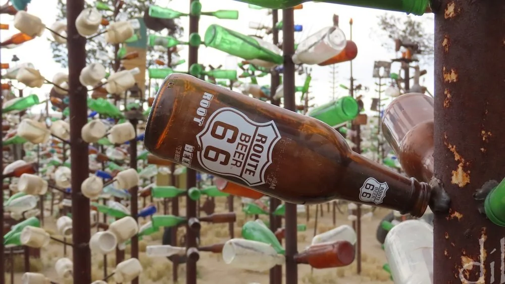
In the 1950s Elmer Long and his father would gather and catalog bottles and other objects they found on long, rambling drives on and off Route 66 in the Mojave Desert. One day Long tied some of those bottles to a post in the yard and was delighted how the sun and wind played with them. Thus was Elmer's Bottle Tree Ranch born. By the time of his death in 2019 Elmer had "grown" more than 200 such trees on his lot near Oro Grande, Calif. It remains open to the public.

Amid Elmer's forest of bottle trees are found objects — road signs, gas pumps, car parts, clocks, oil cans, license plates, streetlights, bicycles, typewriters, weathervanes, tractor seats, toys and animal skulls. You'll have no trouble finding the vintage jeep or bottle-filled boat, but will you track down the gumball machine or surfboard? Especially on a windy day, Elmer's is worth phoning home about.
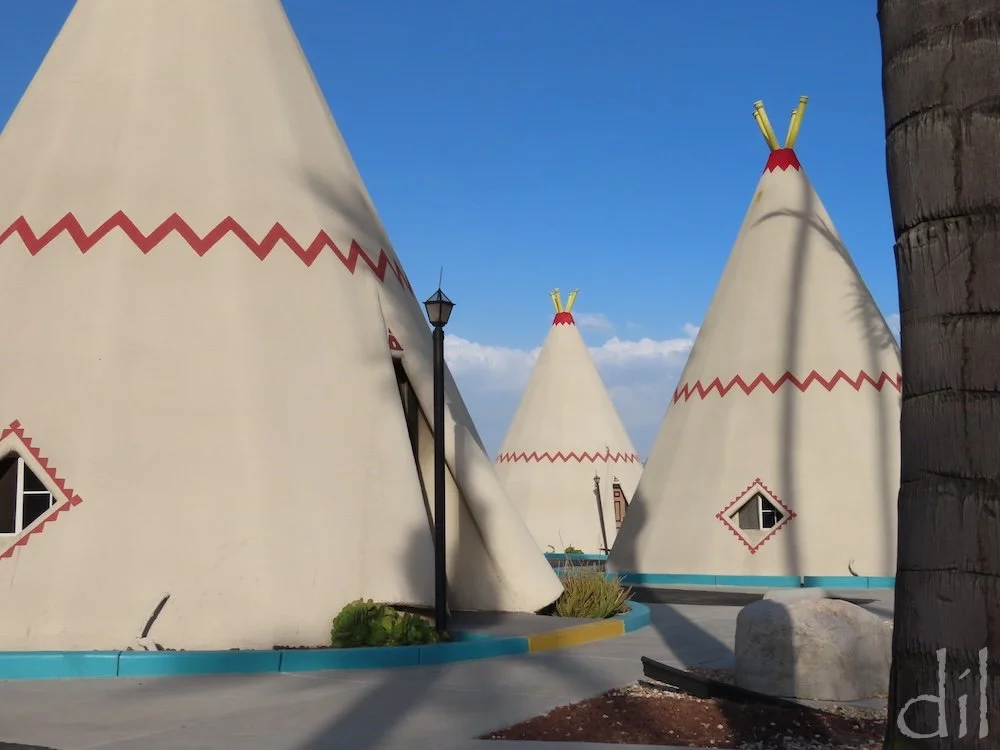
Opened in 1950, Wigwam Motel No. 7, in San Bernardino, Calif., is a sister to the one in Holbrook, Ariz., and the youngest of the seven Wigwam Motels, three of which survive. Founder Frank Redford modeled the tepee-shaped rooms after an ice cream stand he'd seen in Long Beach. Set amid palm trees, each of the 19 restored tepees here stands 32 feet high and comes with its own parking space.
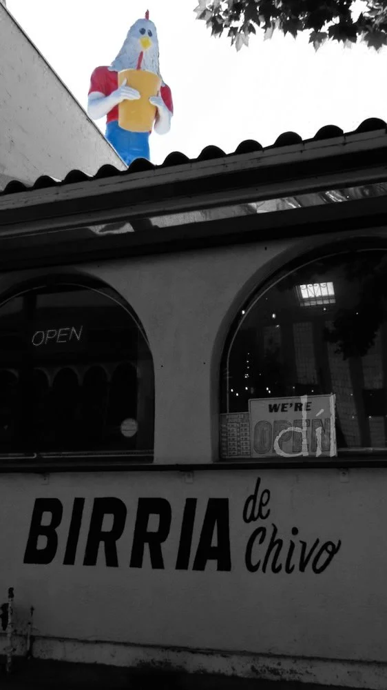
L.A.'s Chicken Boy was a muffler man that was "re-headed" to pitch a fried chicken joint. Restored in 2007 by artist Amy Inoue, he now roosts above her Figueroa Street studio.
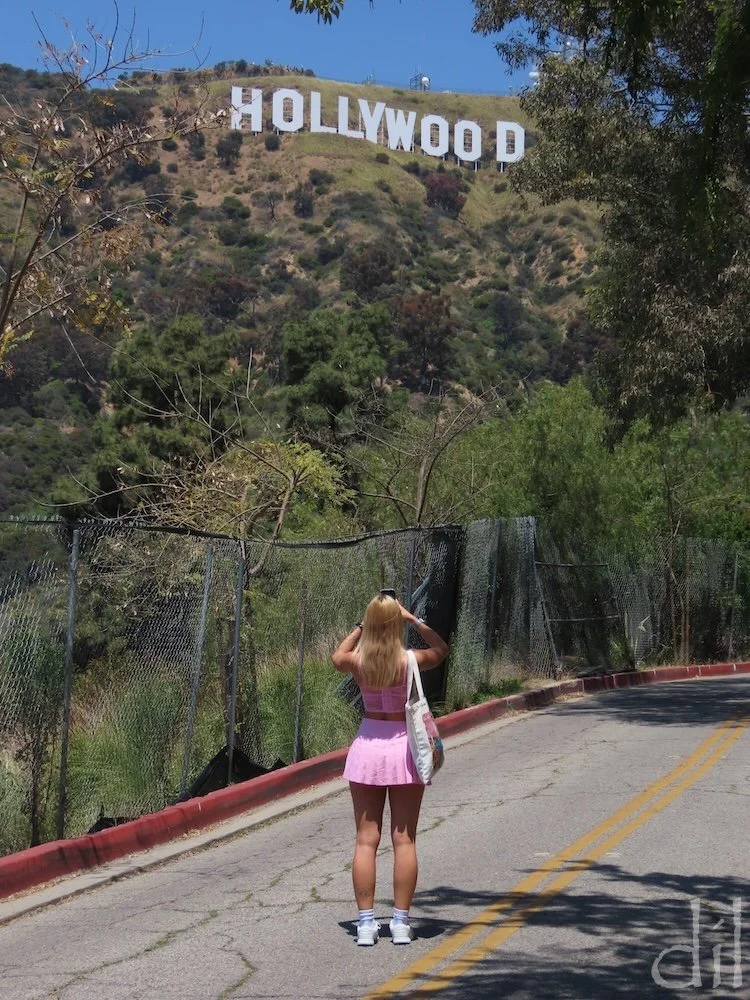
For the closest view of the iconic 45-foot-tall Hollywood sign, drive to the top of Mulholland Highway in the Santa Monica Mountains. If your timing is right, a Barbie lookalike may stroll into your viewfinder for a classic Tinseltown snapshot.

The official western terminus of Route 66 is at the busy intersection of Olympic and Lincoln Boulevards in Santa Monica. That strikes many as a letdown, so in 2009 a group of roadies ceremonially declared the Santa Monica Pier the terminus, erecting an "End of the Trail" sign and an information kiosk, 66-to-Cali. Bring proof of your end-to-end drive, and kiosk manager Ian Bowen will present you a Certificate of Completion — your Route 66 diploma!

At the "End of the Trail," Route 66 diplomas in our back pockets, Dad and I celebrate our nearly 4,000-mile odyssey on the Mother Road.